MyTopo
King Draw New Mexico US Topo Map
Couldn't load pickup availability
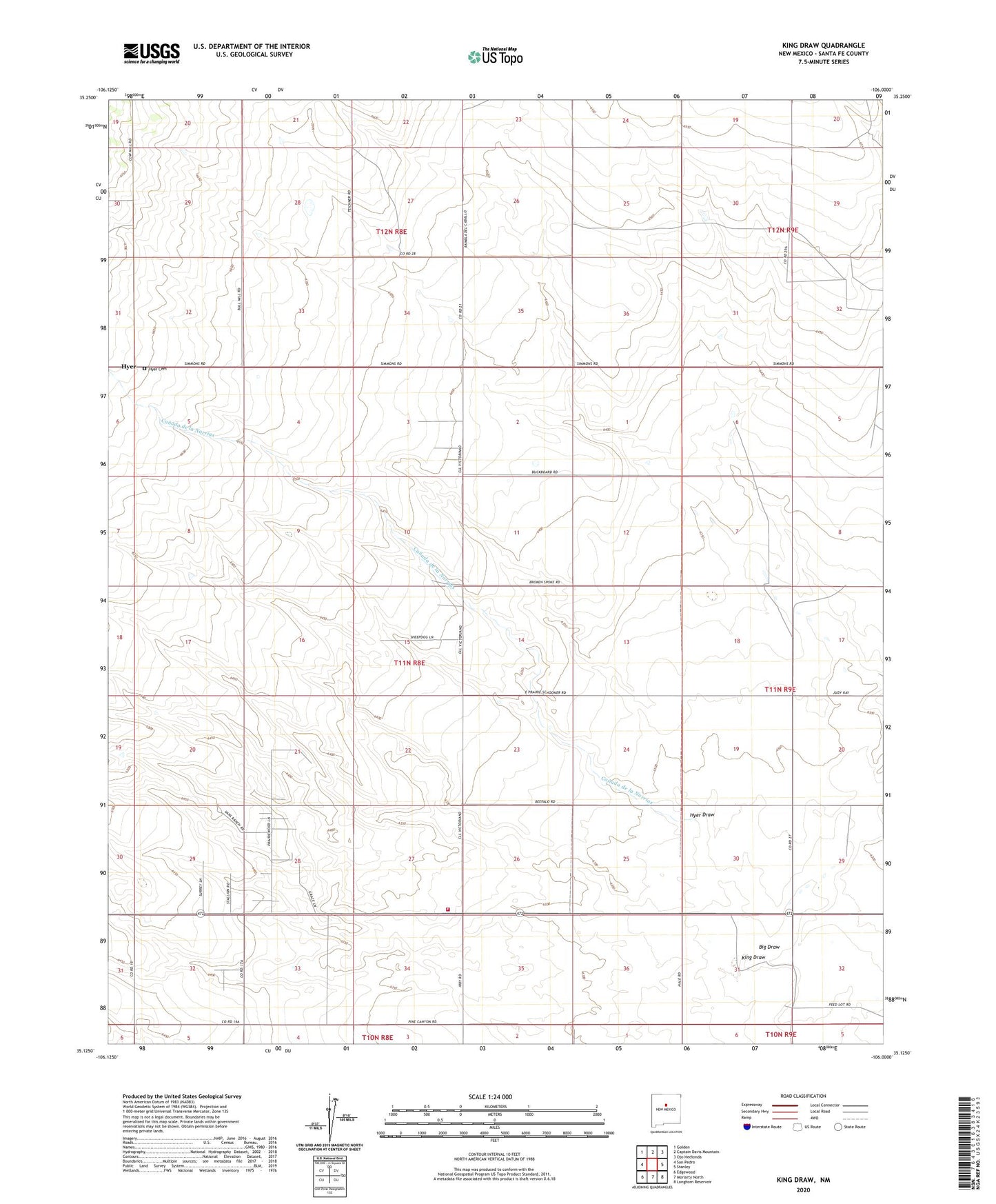
2020 topographic map quadrangle King Draw in the state of New Mexico. Scale: 1:24000. Based on the newly updated USGS 7.5' US Topo map series, this map is in the following counties: Santa Fe. The map contains contour data, water features, and other items you are used to seeing on USGS maps, but also has updated roads and other features. This is the next generation of topographic maps. Printed on high-quality waterproof paper with UV fade-resistant inks.
Quads adjacent to this one:
West: San Pedro
Northwest: Golden
North: Captain Davis Mountain
Northeast: Ojo Hedionda
East: Stanley
Southeast: Longhorn Reservoir
South: Moriarty North
Southwest: Edgewood
Contains the following named places: 10264 Water Well, Big Draw, Big Sky Airport, Canada de la Narrias, F Yates Ranch, Fullingim Ranch, Godec Ranch, Hyer, Hyer Cemetery, Hyer Draw, Hyer Post Office, Irby Ranch, J Yates Ranch, King Bros Ranch, King Draw, P Simmons Place, Santa Fe County Volunteer Fire Stanley District Station 1, Van Scoyk Ranch