MyTopo
Captain Davis Mountain New Mexico US Topo Map
Couldn't load pickup availability
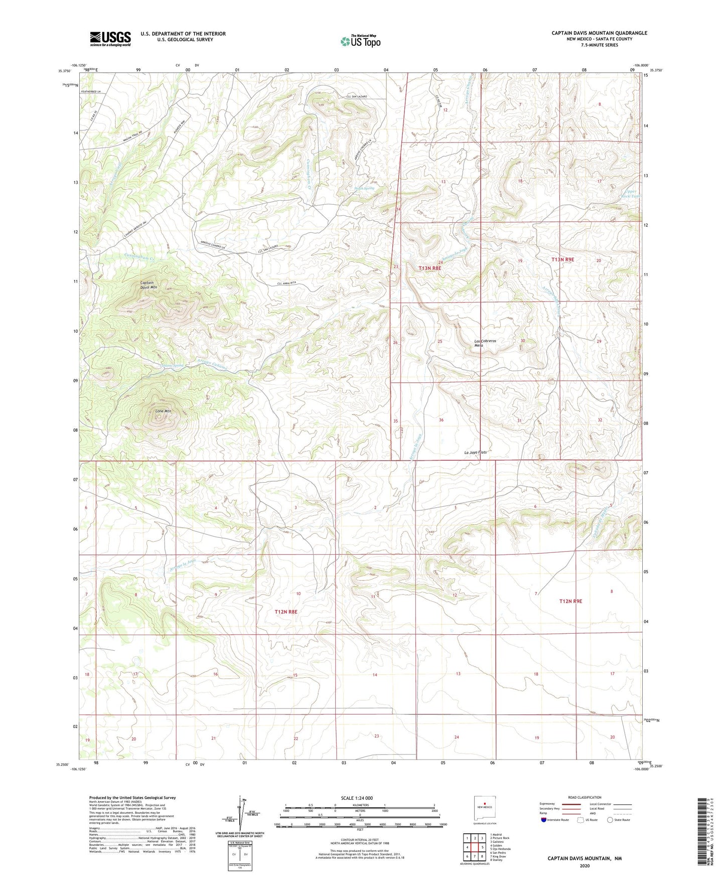
2023 topographic map quadrangle Captain Davis Mountain in the state of New Mexico. Scale: 1:24000. Based on the newly updated USGS 7.5' US Topo map series, this map is in the following counties: Santa Fe. The map contains contour data, water features, and other items you are used to seeing on USGS maps, but also has updated roads and other features. This is the next generation of topographic maps. Printed on high-quality waterproof paper with UV fade-resistant inks.
Quads adjacent to this one:
West: Golden
Northwest: Madrid
North: Picture Rock
Northeast: Galisteo
East: Ojo Hedionda
Southeast: Stanley
South: King Draw
Southwest: San Pedro
This map covers the same area as the classic USGS quad with code o35106c1.
Contains the following named places: Arroyo Canamo, Arroyo la Joya, Arroyo San Lazaro, Bullmill Camp, Canamo Spring, Captain Davis Mountain, Dennison Place, Dennison Post Office, Dolores, Dolores Mine, Gage Well, Indo Windmill, La Joya Flats, La Joya Wind Mill Water Well, La Joya Windmill, Lone Mountain, Los Cobreros Mesa, Mine Shack Water Well, Monero, Peach Spring, RG-22911 Water Well, Tinen Place, Universal