MyTopo
Stanley New Mexico US Topo Map
Couldn't load pickup availability
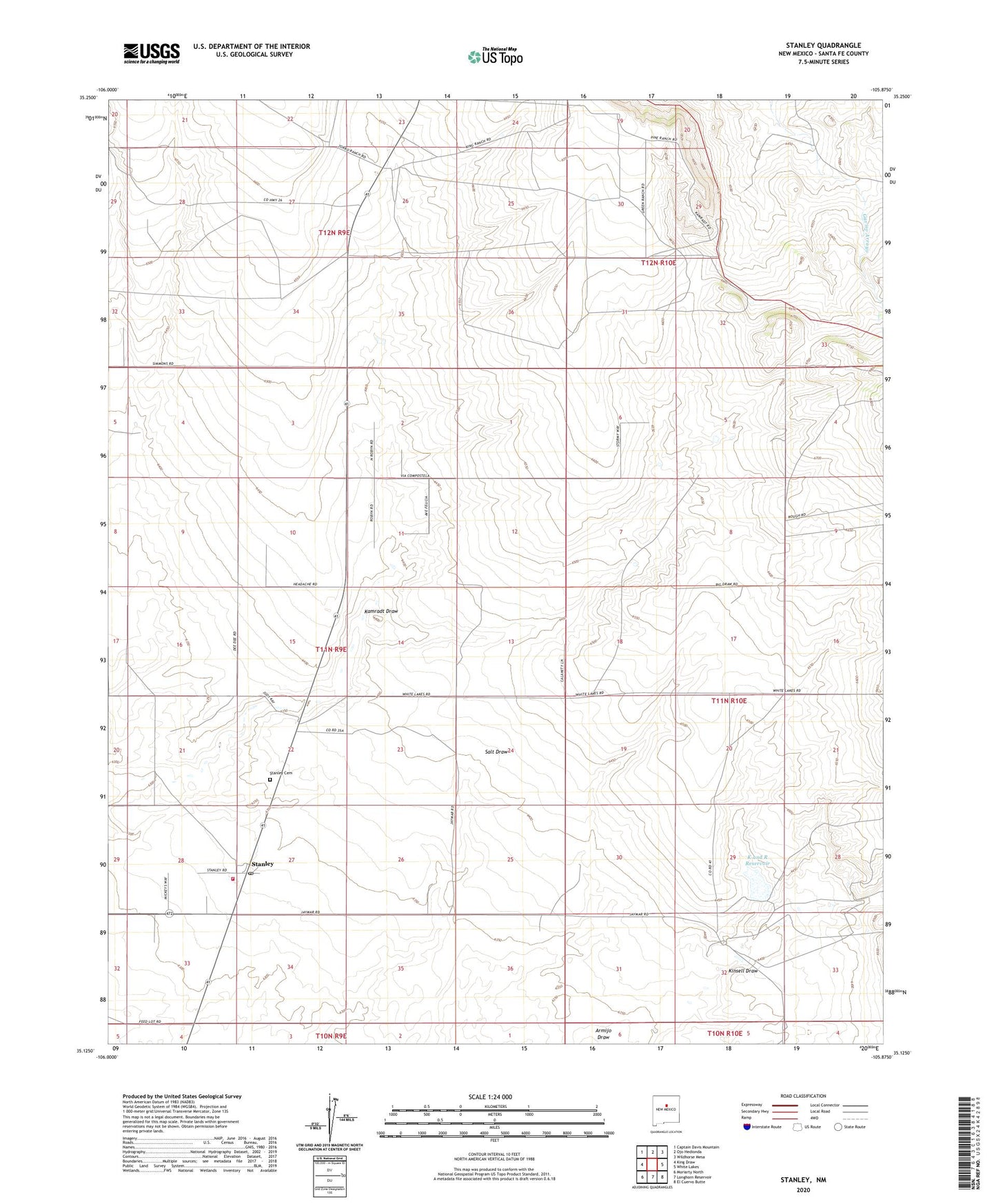
2023 topographic map quadrangle Stanley in the state of New Mexico. Scale: 1:24000. Based on the newly updated USGS 7.5' US Topo map series, this map is in the following counties: Santa Fe. The map contains contour data, water features, and other items you are used to seeing on USGS maps, but also has updated roads and other features. This is the next generation of topographic maps. Printed on high-quality waterproof paper with UV fade-resistant inks.
Quads adjacent to this one:
West: King Draw
Northwest: Captain Davis Mountain
North: Ojo Hedionda
Northeast: Wildhorse Mesa
East: White Lakes
Southeast: El Cuervo Butte
South: Longhorn Reservoir
Southwest: Moriarty North
This map covers the same area as the classic USGS quad with code o35105b8.
Contains the following named places: 10078 Water Well, 87056, Bill Kamradt Ranch, Fisher Ranch, Fronabarger Ranch, K and R Reservoir, Kamradt Draw, Kamradt Ranch, Kinsell Draw, Kinsell Ranch, Kinsell Reservoir Dam, Landon Windmill, Miller Ranch, Mitchell Ranch, Santa Fe County Volunteer Fire Stanley District Station 2, Stanley, Stanley Cemetery, Stanley Census Designated Place, Stanley Post Office, Watson Ranch, West Otto Site