MyTopo
Kiowa New Mexico US Topo Map
Couldn't load pickup availability
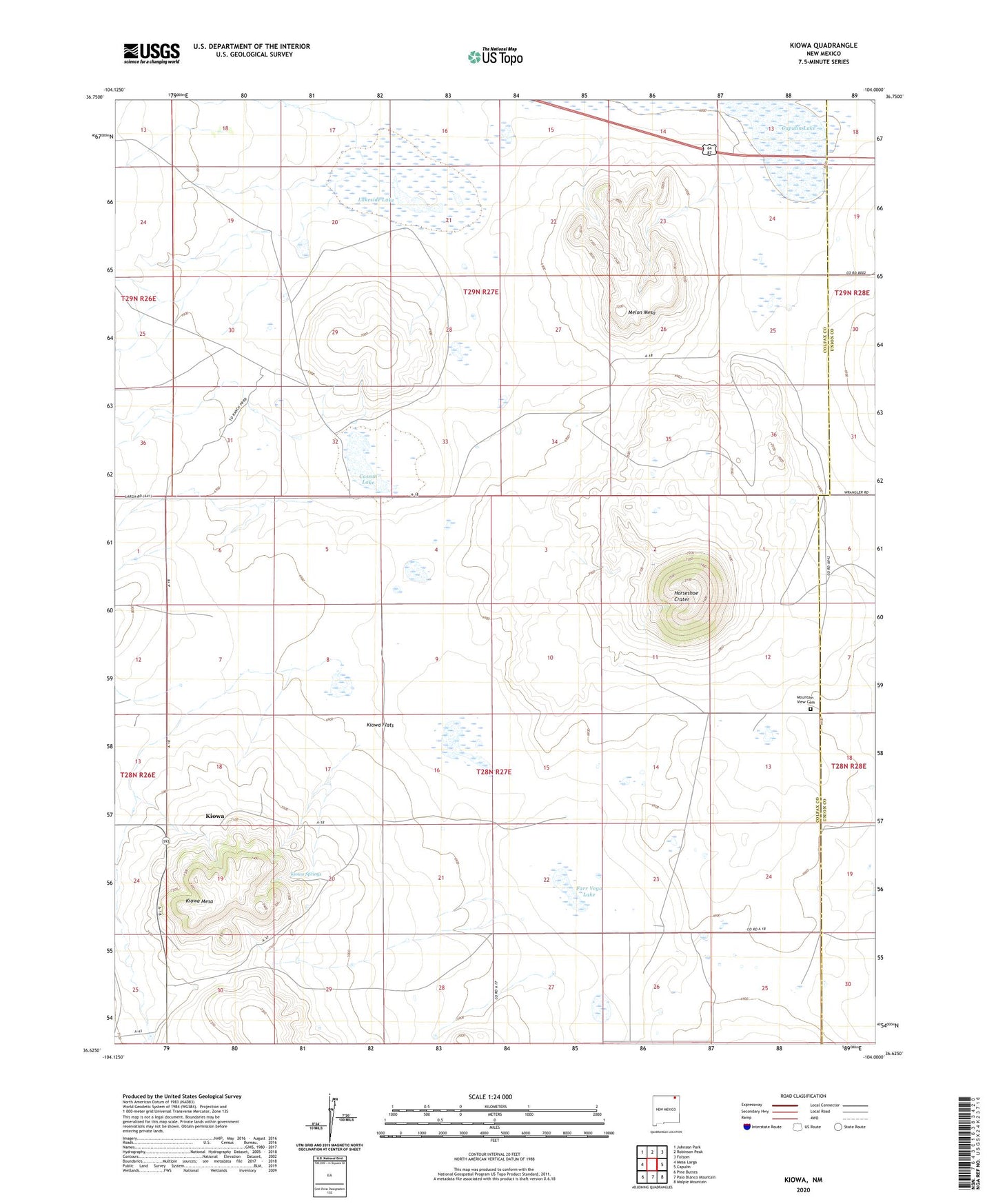
2020 topographic map quadrangle Kiowa in the state of New Mexico. Scale: 1:24000. Based on the newly updated USGS 7.5' US Topo map series, this map is in the following counties: Colfax, Union. The map contains contour data, water features, and other items you are used to seeing on USGS maps, but also has updated roads and other features. This is the next generation of topographic maps. Printed on high-quality waterproof paper with UV fade-resistant inks.
Quads adjacent to this one:
West: Mesa Larga
Northwest: Johnson Park
North: Robinson Peak
Northeast: Folsom
East: Capulin
Southeast: Malpie Mountain
South: Palo Blanco Mountain
Southwest: Pine Buttes
Contains the following named places: 10005 Water Well, 10006 Water Well, Bural, Capulin Lake, Cassan Lake, Chacon Arroyo, Cunico, Cunico Weather Station, Farr Vega Lake, Fort Union Road, Horse Shoe Crater, Horseshoe Crater, Kiowa, Kiowa Flats, Kiowa Mesa, Kiowa Post Office, Kiowa Springs, Lakeside Lake, Melon Mesa, Mountain View Cemetery, Wheeler, Widow Lake