MyTopo
Johnson Park New Mexico US Topo Map
Couldn't load pickup availability
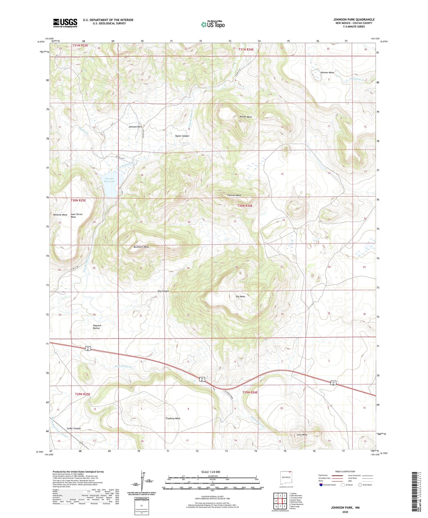
2023 topographic map quadrangle Johnson Park in the state of New Mexico. Scale: 1:24000. Based on the newly updated USGS 7.5' US Topo map series, this map is in the following counties: Colfax. The map contains contour data, water features, and other items you are used to seeing on USGS maps, but also has updated roads and other features. This is the next generation of topographic maps. Printed on high-quality waterproof paper with UV fade-resistant inks.
Quads adjacent to this one:
West: Hunter Mesa
Northwest: Yankee
North: Dale Mountain
Northeast: Trinchera Pass
East: Robinson Peak
Southeast: Kiowa
South: Mesa Larga
Southwest: Tinaja Mountain
This map covers the same area as the classic USGS quad with code o36104g2.
Contains the following named places: B T U, Buckhorn Mesa, Burke, Cedar Canyon, Dry Canyon, Dry Mesa, Flatiron Mesa, Haycock Buttes, Hunter Creek, Johnson Park, Loco Mesa, Meloche Mesa, Popejoy, Taylor Canyon, Throttle Dam, Throttle Reservoir, Wilson Mesa