MyTopo
Kirtland New Mexico US Topo Map
Couldn't load pickup availability
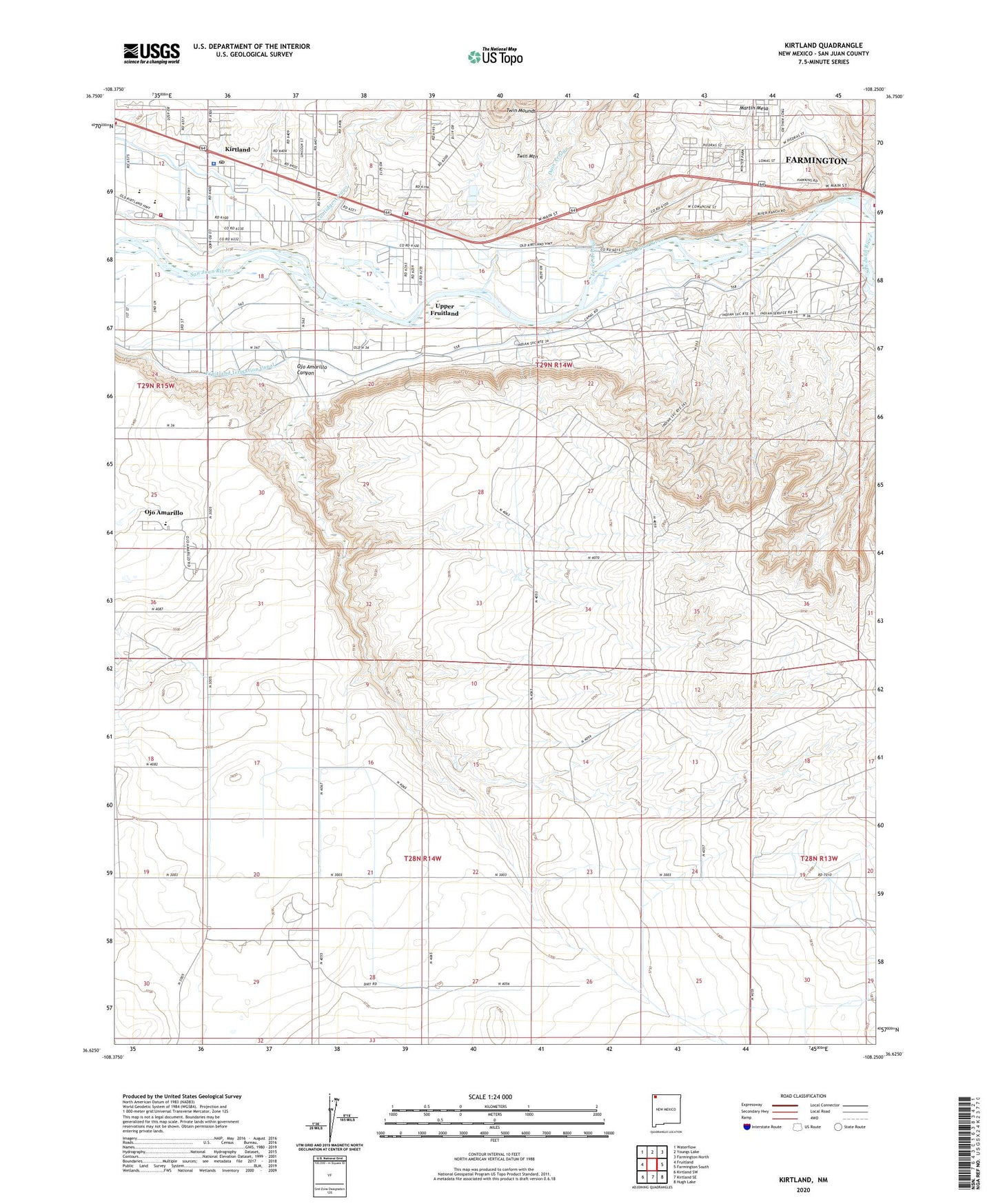
2023 topographic map quadrangle Kirtland in the state of New Mexico. Scale: 1:24000. Based on the newly updated USGS 7.5' US Topo map series, this map is in the following counties: San Juan. The map contains contour data, water features, and other items you are used to seeing on USGS maps, but also has updated roads and other features. This is the next generation of topographic maps. Printed on high-quality waterproof paper with UV fade-resistant inks.
Quads adjacent to this one:
West: Fruitland
Northwest: Waterflow
North: Youngs Lake
Northeast: Farmington North
East: Farmington South
Southeast: Hugh Lake
South: Kirtland SE
Southwest: Kirtland SW
This map covers the same area as the classic USGS quad with code o36108f3.
Contains the following named places: Central High School, Central Junior High School, Coolidge Arroyo, Dain Arroyo, Davenport Airport, Deeper Faith Ministries Church, First Baptist Church, Grace B Wilson School, Harper Hill Pit, Kirtland, Kirtland Census Designated Place, Kirtland Elementary School, Kirtland Middle School, Kirtland Post Office, La Plata River, Locke Arroyo, Ojo Amarillo, Ojo Amarillo Canyon, Ojo Amarillo Census Designated Place, Rose Garden Cemetery, Ruth N Bond Elementary School, Saint Michael Church, San Juan County Fire District 1 - Valley Station 1, San Juan County Fire District 1 - Valley Station 2, San Juan County Fire District 1 Valley Station 4, San Juan County Sheriff's Office Kirtland, The Church of Jesus Christ of Latter Day Saints, Town of Kirtland, Twin Mounds, Twin Mountain, University of New Mexico Experimental Farm, Upper Fruitland, Upper Fruitland Census Designated Place, ZIP Code: 87417