MyTopo
Koger Ranch New Mexico US Topo Map
Couldn't load pickup availability
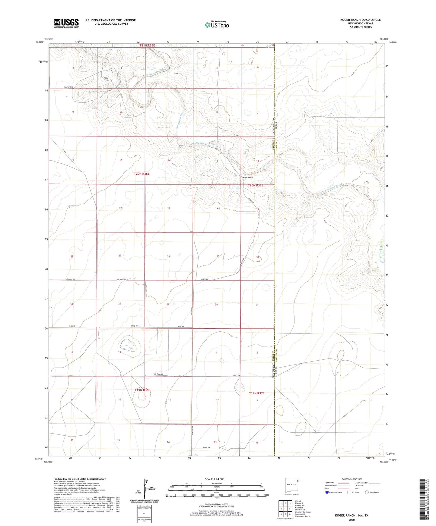
2023 topographic map quadrangle Koger Ranch in the states of New Mexico, Texas. Scale: 1:24000. Based on the newly updated USGS 7.5' US Topo map series, this map is in the following counties: Union, Hartley. The map contains contour data, water features, and other items you are used to seeing on USGS maps, but also has updated roads and other features. This is the next generation of topographic maps. Printed on high-quality waterproof paper with UV fade-resistant inks.
Quads adjacent to this one:
West: Amistad
Northwest: Stead
North: Sedan SE
Northeast: Windy Hill
East: Beck Ranch
Southeast: Whiteaker Ranch
South: Amistad SE
Southwest: Centerville Corner
Contains the following named places: Amistad Land and Cattle Company Airport, Anchute Well, Bass Hole, Catfish Hole, Daughty Well, Dutche Well, East Creek Well, East Well, Glens Well, Heifer Well, Koger Ranch, Lake Well, Middle Creek Well, North School Section Well, North Well, Pat Well, School Section Well, South Well, Tracy Well, Tramperos Creek, Watermelon Well, West Creek Well