MyTopo
La Union New Mexico US Topo Map
Couldn't load pickup availability
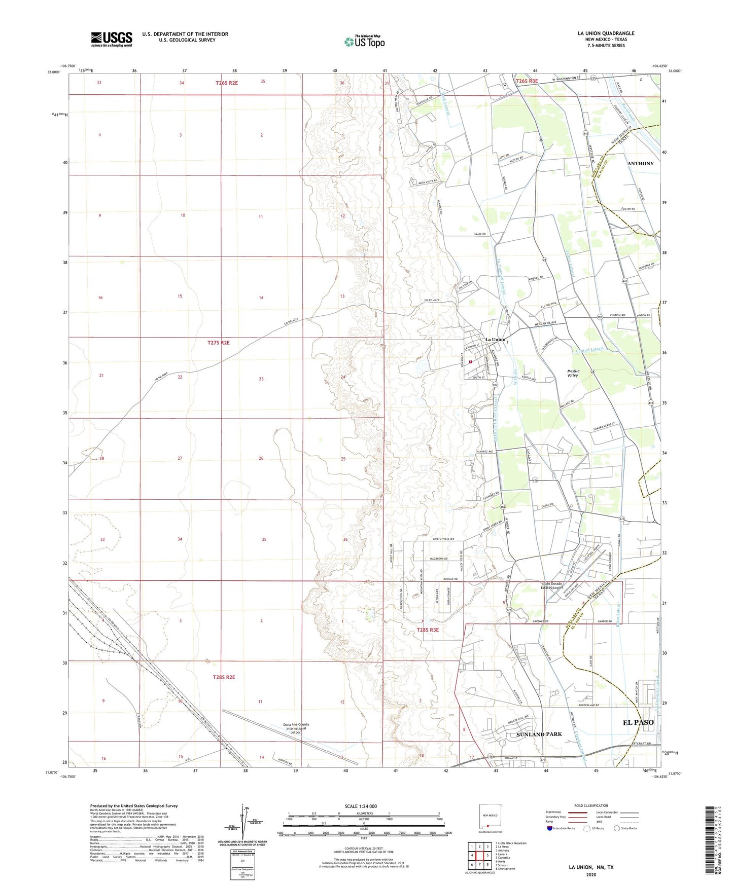
2023 topographic map quadrangle La Union in the state of New Mexico. Scale: 1:24000. Based on the newly updated USGS 7.5' US Topo map series, this map is in the following counties: Doña Ana, El Paso. The map contains contour data, water features, and other items you are used to seeing on USGS maps, but also has updated roads and other features. This is the next generation of topographic maps. Printed on high-quality waterproof paper with UV fade-resistant inks.
Quads adjacent to this one:
West: Lanark
Northwest: Little Black Mountain
North: La Mesa
Northeast: Anthony
East: Canutillo
Southeast: Smeltertown
South: Strauss
Southwest: Noria
Contains the following named places: 10128 Water Well, 10129 Water Well, 10130 Water Well, 10131 Water Well, 10135 Water Well, 10139 Water Well, 10162 Water Well, Baker Lateral, Central Drain, Central Lateral, Central School, Cielo Dorado Estates Airport, Dona Ana County Fire Department - Station 7 La Union, Dona Ana County International Jetport, Gadsden High School, Gadsden Junior and Senior High School, Gadsden Junior High School, La Union, La Union Cemetery, La Union Census Designated Place, La Union East Lateral, La Union Test Water Well, La Union Vieja, La Union West Lateral, Little La Union Lateral, NM 4903611 Water Well, NM 4903614 Water Well, NM 4903-907 Water Well, NM4903307 Water Well, Q 111 Water Well, Q 46 Water Well, Q 9 Water Well, Q-1 Water Well, Q-100 Water Well, Q-101 Water Well, Q-103 Water Well, Q-141 Water Well, Q-164 Water Well, Q-184 Water Well, Q-41 Water Well, Q-42 Water Well, Q-48 Water Well, Q-55 Water Well, Q-59 Water Well, Q-6 Water Well, Q-96 Water Well, Q-98 Water Well, Saint Lukes Church, T-7 Water Well, Talbot Lateral, West Drain, X-7 Water Well