MyTopo
Strauss New Mexico US Topo Map
Couldn't load pickup availability
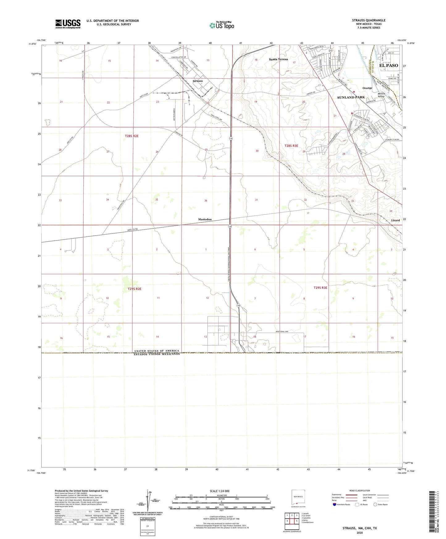
2023 topographic map quadrangle Strauss in the state of New Mexico. Scale: 1:24000. Based on the newly updated USGS 7.5' US Topo map series, this map is in the following counties: Doña Ana, El Paso. The map contains contour data, water features, and other items you are used to seeing on USGS maps, but also has updated roads and other features. This is the next generation of topographic maps. Printed on high-quality waterproof paper with UV fade-resistant inks.
Quads adjacent to this one:
West: Noria
Northwest: Lanark
North: La Union
Northeast: Canutillo
East: Smeltertown
Contains the following named places: 10067 Water Well, 10141 Water Well, 10143 Water Well, 10144 Water Well, 10154 Water Well, 10156 Water Well, 10157 Water Well, 10161 Water Well, 10166 Water Well, 10167 Water Well, 10169 Water Well, 10174 Water Well, 10175 Water Well, 10176 Water Well, 88008, Alliance Hospital of Santa Teresa, Crawford Lateral, Lizard, Mastodon, NM 4911302 Water Well, Orange, Orange Post Office, P 16 Water Well, Q 268 Water Well, Q-70 Water Well, Santa Nina Church, Santa Teresa, Santa Teresa Census Designated Place, Santa Teresa Volunteer Fire Department, Strauss, Strauss Post Office, Sunland Park Fire Department Station 2