MyTopo
Lake McMillan North New Mexico US Topo Map
Couldn't load pickup availability
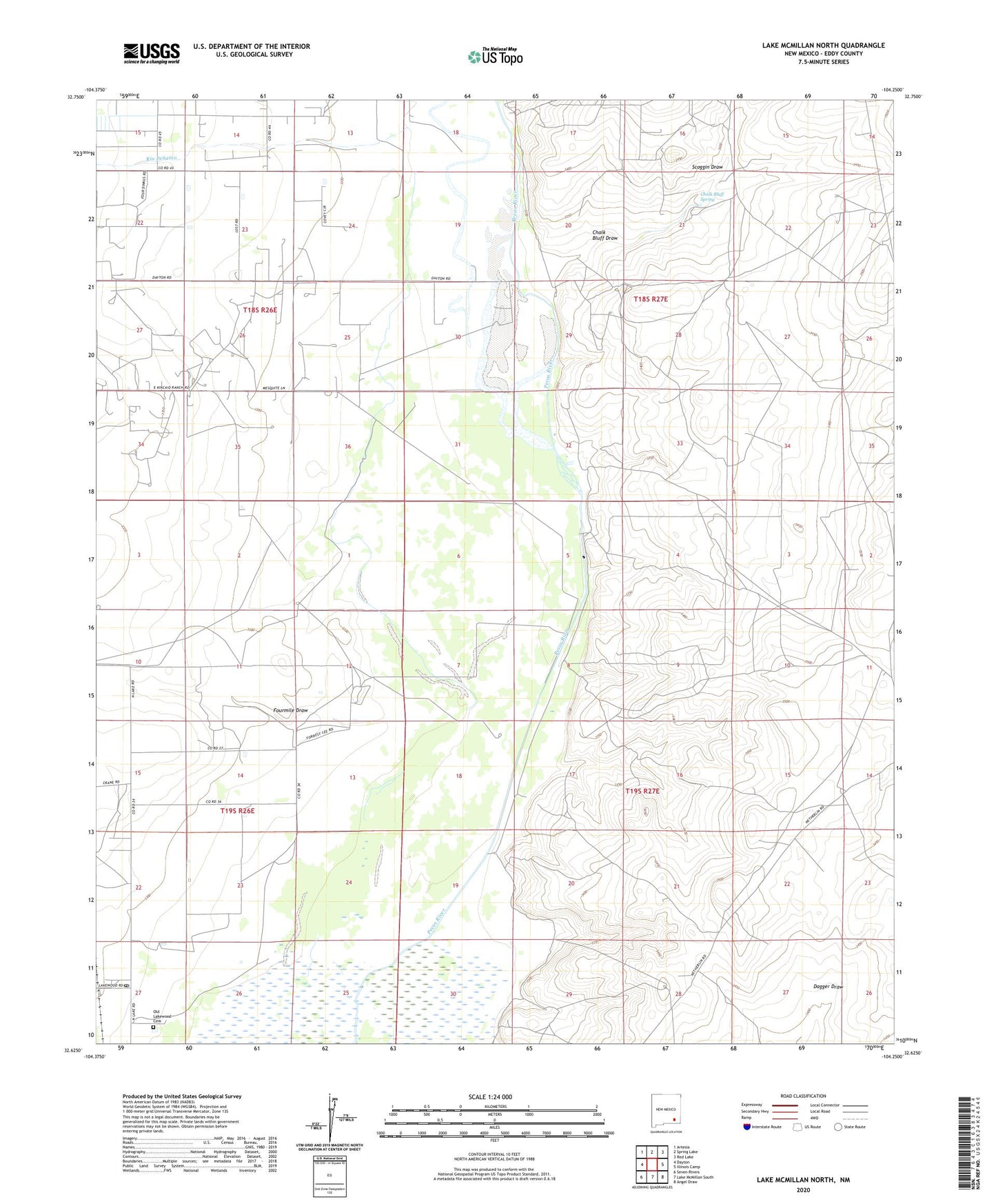
2020 topographic map quadrangle Lake McMillan North in the state of New Mexico. Scale: 1:24000. Based on the newly updated USGS 7.5' US Topo map series, this map is in the following counties: Eddy. The map contains contour data, water features, and other items you are used to seeing on USGS maps, but also has updated roads and other features. This is the next generation of topographic maps. Printed on high-quality waterproof paper with UV fade-resistant inks.
Quads adjacent to this one:
West: Dayton
Northwest: Artesia
North: Spring Lake
Northeast: Red Lake
East: Illinois Camp
Southeast: Angel Draw
South: Lake McMillan South
Southwest: Seven Rivers
Contains the following named places: Chalk Bluff Draw, Chalk Bluff Spring, Fourmile Draw, Kaiser Lake, Lakewood, Lakewood Baptist Church, Lakewood Post Office, Lewis Ranch, Old Lakewood Cemetery, Pecos River, Rio Penasco, Scoggin Draw