MyTopo
Angel Draw New Mexico US Topo Map
Couldn't load pickup availability
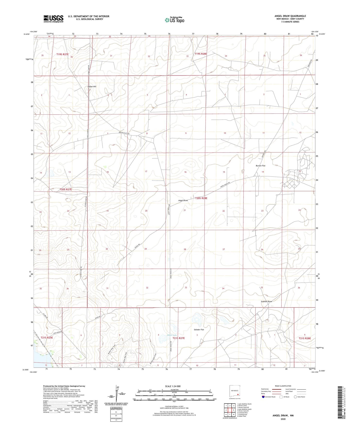
2023 topographic map quadrangle Angel Draw in the state of New Mexico. Scale: 1:24000. Based on the newly updated USGS 7.5' US Topo map series, this map is in the following counties: Eddy. The map contains contour data, water features, and other items you are used to seeing on USGS maps, but also has updated roads and other features. This is the next generation of topographic maps. Printed on high-quality waterproof paper with UV fade-resistant inks.
Quads adjacent to this one:
West: Lake McMillan South
Northwest: Lake McMillan North
North: Illinois Camp
Northeast: Illinois Camp NE
East: Illinois Camp SE
Southeast: Indian Flats
South: Carlsbad East
Southwest: Carlsbad West
This map covers the same area as the classic USGS quad with code o32104e2.
Contains the following named places: 00817 Water Well, 06434 Water Well, 06435 Water Well, 06436 Water Well, 06437 Water Well, 06438 Water Well, 06439 Water Well, 06440 Water Well, 06441 Water Well, 06442 Water Well, 06443 Water Well, 06703 Water Well, 06704 Water Well, 06705 Water Well, 06706 Water Well, 06707 Water Well, 06708 Water Well, 12178 Water Well, 12179 Water Well, Alkali Lake, Angel Draw, Angel Ranch, Bates Ranch, Burton Flat, Indian Hill, Murray Ranch, Murray West Well, Saladar Flat, Scanlon Draw