MyTopo
Lesbia New Mexico US Topo Map
Couldn't load pickup availability
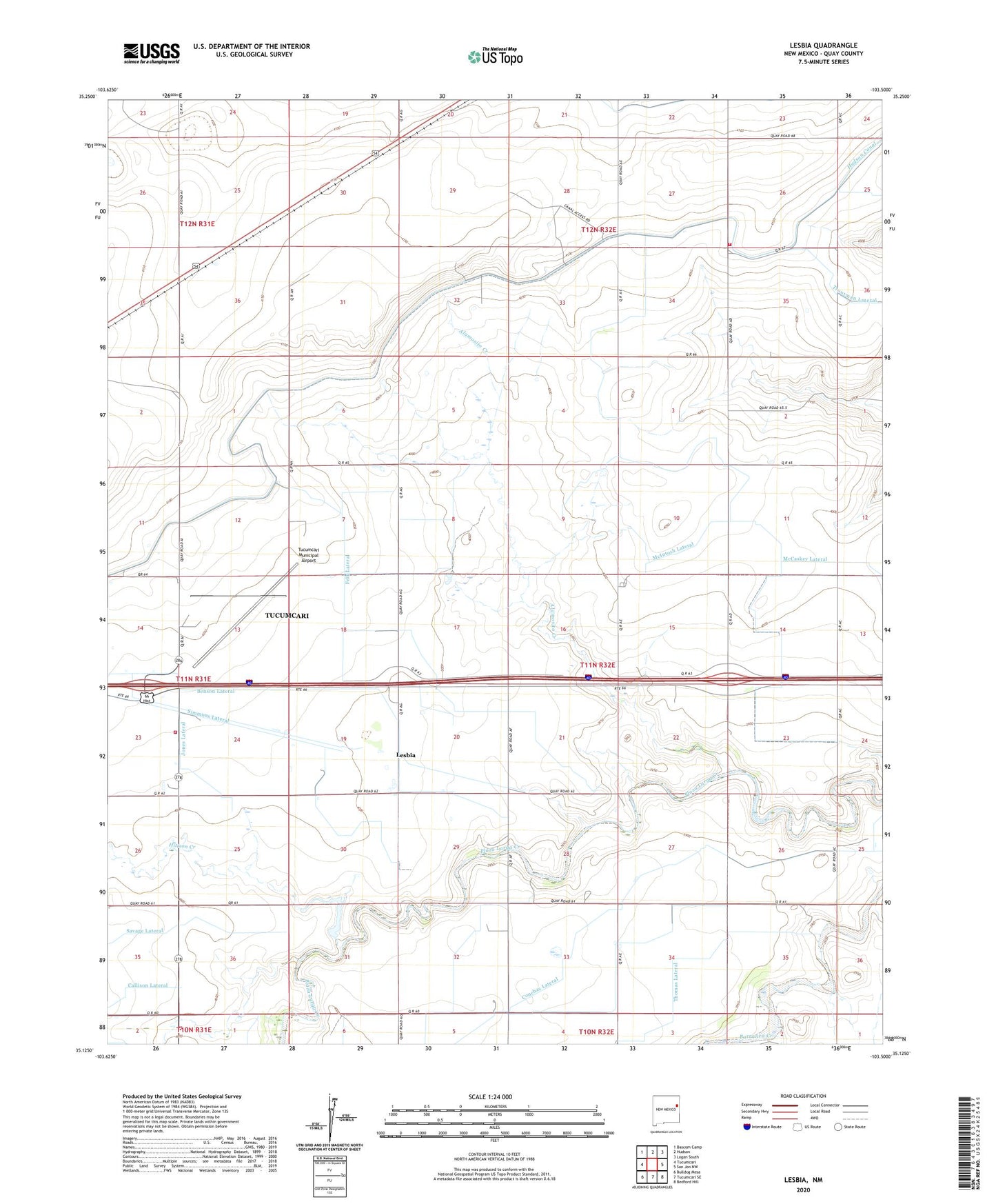
2020 topographic map quadrangle Lesbia in the state of New Mexico. Scale: 1:24000. Based on the newly updated USGS 7.5' US Topo map series, this map is in the following counties: Quay. The map contains contour data, water features, and other items you are used to seeing on USGS maps, but also has updated roads and other features. This is the next generation of topographic maps. Printed on high-quality waterproof paper with UV fade-resistant inks.
Quads adjacent to this one:
West: Tucumcari
Northwest: Bascom Camp
North: Hudson
Northeast: Logan South
East: San Jon NW
Southeast: Bedford Hill
South: Tucumcari SE
Southwest: Bulldog Mesa
Contains the following named places: 05590 Water Well, 05596 Water Well, 05599 Water Well, 05600 Water Well, 05601 Water Well, 05602 Water Well, 05603 Water Well, 05604 Water Well, Adberg, Alamosito Creek, Benson Lateral, Bugg Lateral, Callison Lateral, Conchas Lateral, Conservancy Fire District 2 Main Station, Conservancy Fire District 2 Substation, Conservancy Fire District 3 Substation 1, Felk Lateral, Frio, Gaudin Lateral, Gravy, Henry, Hittson Creek, Hittson Creek Dam, Jones Lateral, Lesbia, Lesbia Post Office, Maes, McIntosh Lateral, Newby, Simmons Lateral, Thomas Lateral, Troutman Lateral, Tucumcari Municipal Airport