MyTopo
San Jon NW New Mexico US Topo Map
Couldn't load pickup availability
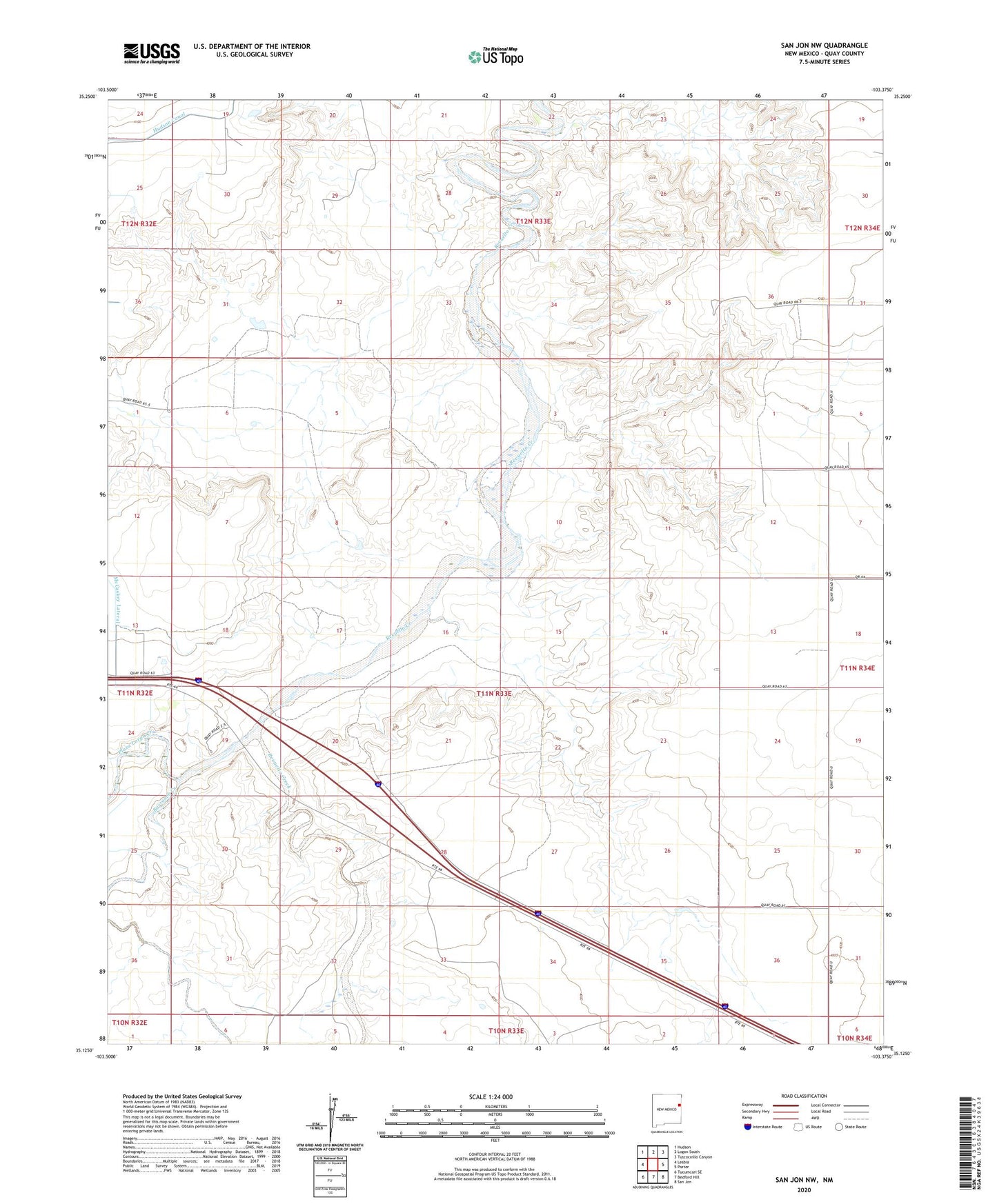
2023 topographic map quadrangle San Jon NW in the state of New Mexico. Scale: 1:24000. Based on the newly updated USGS 7.5' US Topo map series, this map is in the following counties: Quay. The map contains contour data, water features, and other items you are used to seeing on USGS maps, but also has updated roads and other features. This is the next generation of topographic maps. Printed on high-quality waterproof paper with UV fade-resistant inks.
Quads adjacent to this one:
West: Lesbia
Northwest: Hudson
North: Logan South
Northeast: Tuscocoillo Canyon
East: Porter
Southeast: San Jon
South: Bedford Hill
Southwest: Tucumcari SE
This map covers the same area as the classic USGS quad with code o35103b4.
Contains the following named places: 05632 Water Well, 05633 Water Well, 05635 Water Well, 05636 Water Well, 05637 Water Well, 05638 Water Well, Barranca Creek, Hudson Canal, McCaskey Lateral, Plaza Larga Creek, Smith, Sours Lateral, Troutman Ranch