MyTopo
Loma Parda New Mexico US Topo Map
Couldn't load pickup availability
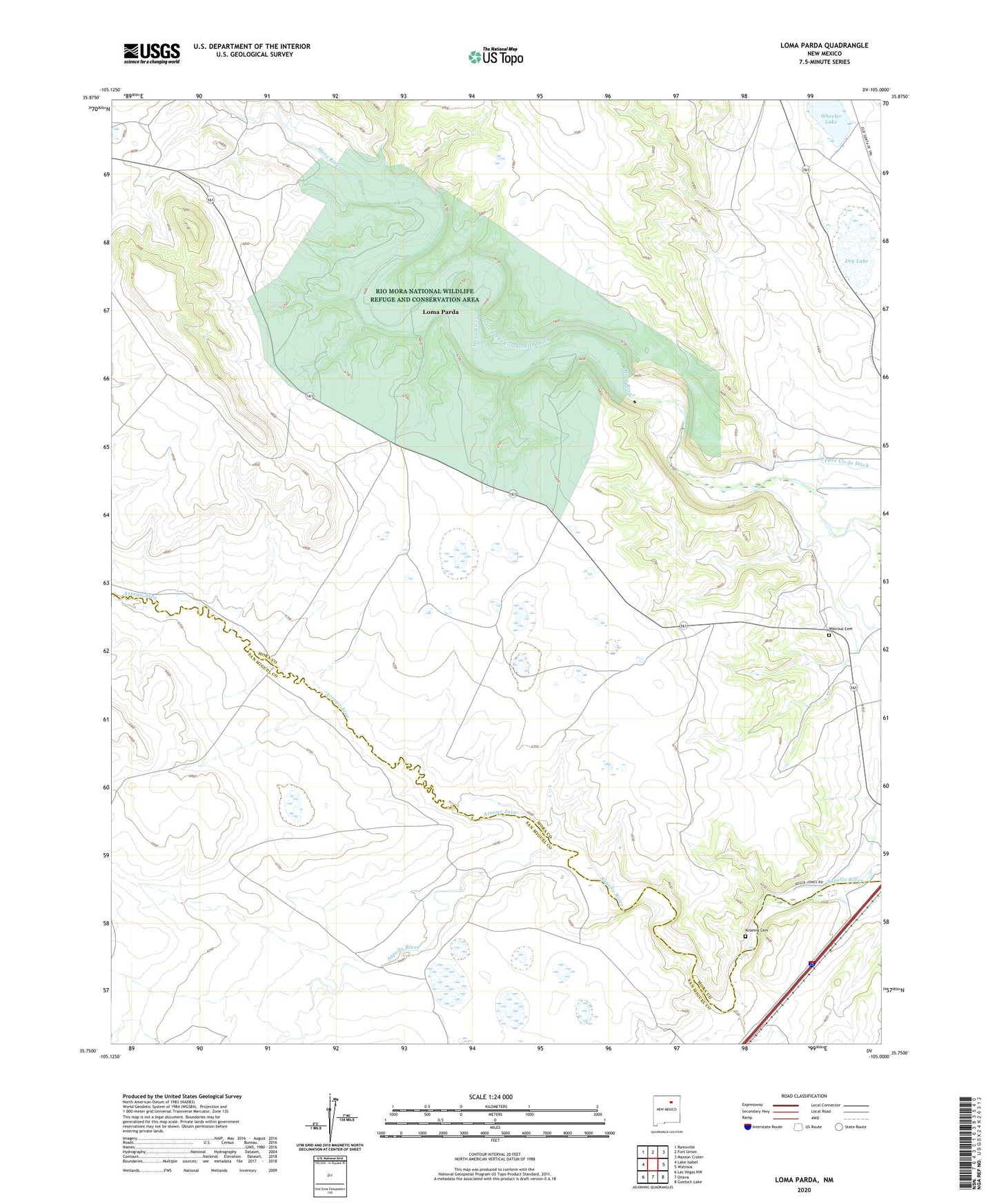
2023 topographic map quadrangle Loma Parda in the state of New Mexico. Scale: 1:24000. Based on the newly updated USGS 7.5' US Topo map series, this map is in the following counties: Mora, San Miguel. The map contains contour data, water features, and other items you are used to seeing on USGS maps, but also has updated roads and other features. This is the next generation of topographic maps. Printed on high-quality waterproof paper with UV fade-resistant inks.
Quads adjacent to this one:
West: Lake Isabel
Northwest: Rainsville
North: Fort Union
Northeast: Maxson Crater
East: Watrous
Southeast: Goetsch Lake
South: Onava
Southwest: Las Vegas NW
This map covers the same area as the classic USGS quad with code o35105g1.
Contains the following named places: Arroyo Jara, Dry Lake, Fort Union Corral, Jones, Kroenig Cemetery, Loma Parda, Loma Parda Community Ditch, Loma Parda Post Office, Low, Martinez, Rio Mora National Wildlife Refuge and Conservation Area, Upper Clyde Ditch, Upper Phoenix Ditch, Watrous Cemetery, Wheeler Lake