MyTopo
Watrous New Mexico US Topo Map
Couldn't load pickup availability
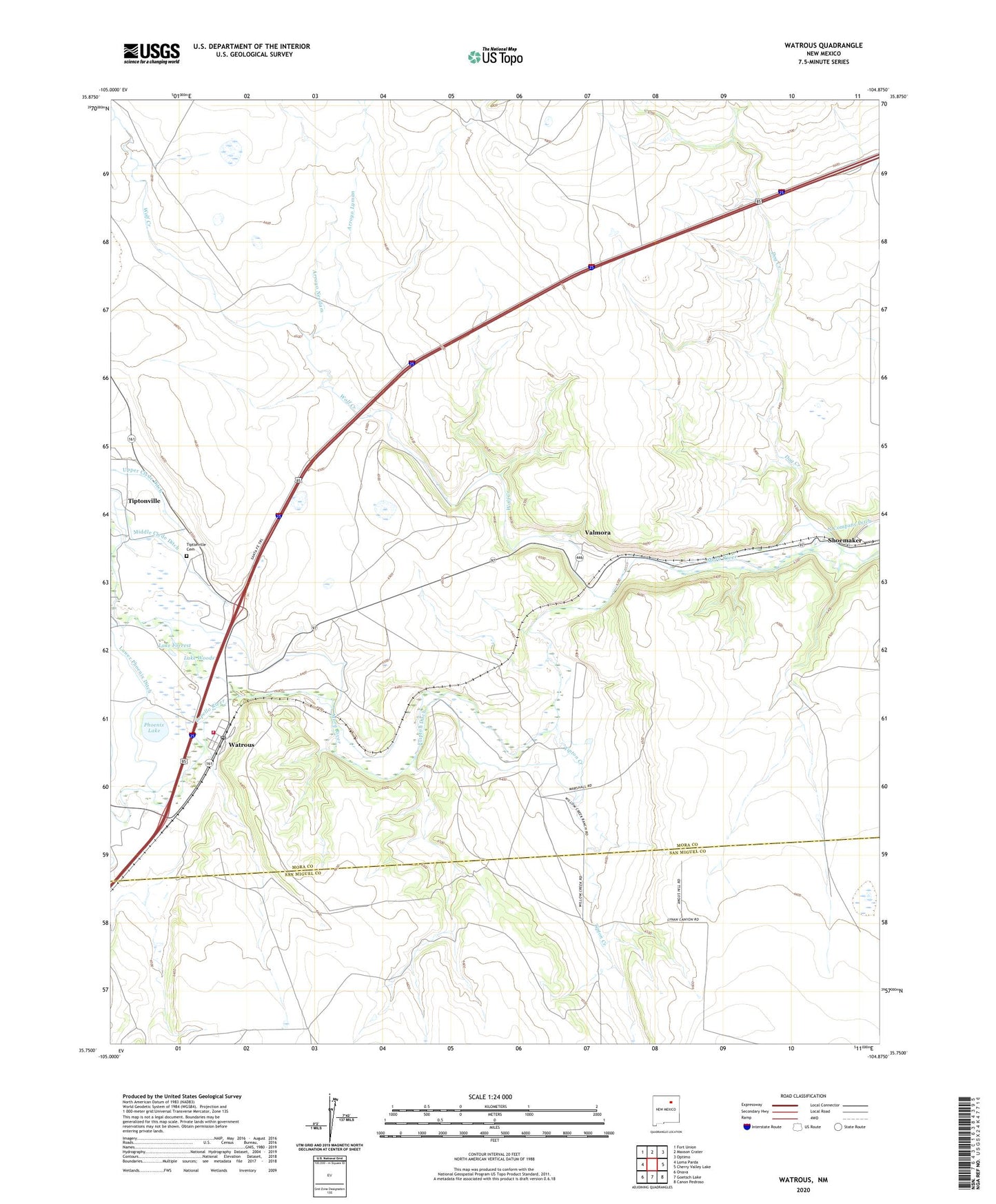
2023 topographic map quadrangle Watrous in the state of New Mexico. Scale: 1:24000. Based on the newly updated USGS 7.5' US Topo map series, this map is in the following counties: Mora, San Miguel. The map contains contour data, water features, and other items you are used to seeing on USGS maps, but also has updated roads and other features. This is the next generation of topographic maps. Printed on high-quality waterproof paper with UV fade-resistant inks.
Quads adjacent to this one:
West: Loma Parda
Northwest: Fort Union
North: Maxson Crater
Northeast: Optimo
East: Cherry Valley Lake
Southeast: Canon Pedroso
South: Goetsch Lake
Southwest: Onava
This map covers the same area as the classic USGS quad with code o35104g8.
Contains the following named places: Arroyo Lyman, Arroyo Needam, Boone Valley, Carl W Wildensteins House Historic Site, Dog Creek, Doolittle Ranch Airport, Enoch Tipton Ranch House, John Scolly Land Grant, Joseph B Watrous Ranch Historic Site, Lake Forrest, Lake Woods, Lower Phoenix Ditch, Middle Clyde Ditch, North Company Ditch, Phoenix Lake, Sapello River, Sellman Brothers, Shoemaker, Shoemaker Post Office, Tipton Creek, Tipton Ditch, Tiptonville, Tiptonville Cemetery, Tiptonville Post Office, Valmora, Valmora Post Office, Valmora Sanatorium Historic District, Valmora Weather Station, Walter W Lyman Ranch House, Watrous, Watrous Census Designated Place, Watrous Historical Marker, Watrous Post Office, Watrous Volunteer Fire Department, William Kroenig Hay Barns Number 51 and Number 52, William Kroenig Ranch Complex Historic Site, Wolf Creek, ZIP Codes: 87750, 87753