MyTopo
Longhorn Reservoir New Mexico US Topo Map
Couldn't load pickup availability
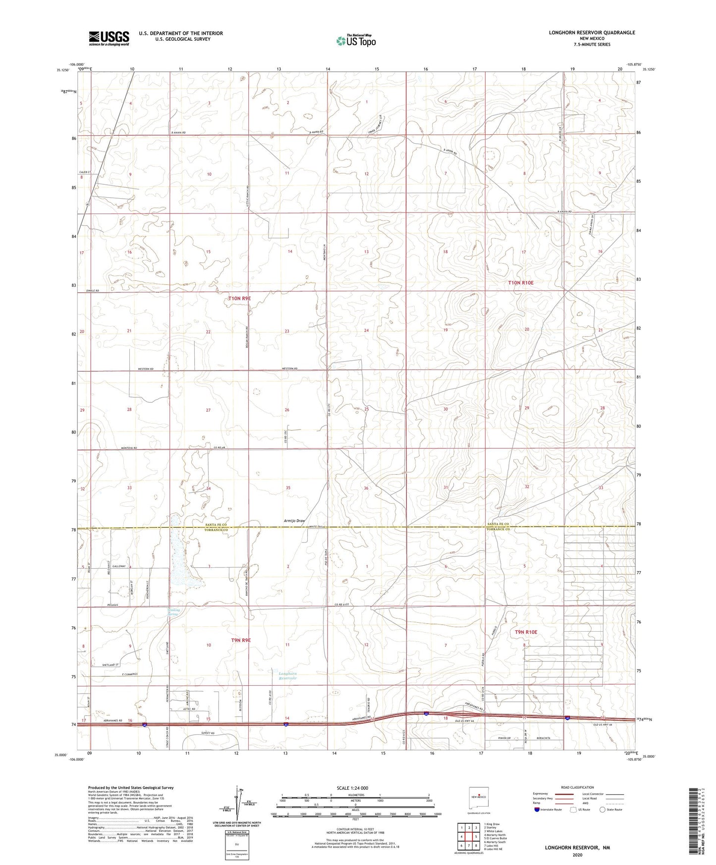
2020 topographic map quadrangle Longhorn Reservoir in the state of New Mexico. Scale: 1:24000. Based on the newly updated USGS 7.5' US Topo map series, this map is in the following counties: Santa Fe, Torrance. The map contains contour data, water features, and other items you are used to seeing on USGS maps, but also has updated roads and other features. This is the next generation of topographic maps. Printed on high-quality waterproof paper with UV fade-resistant inks.
Quads adjacent to this one:
West: Moriarty North
Northwest: King Draw
North: Stanley
Northeast: White Lakes
East: El Cuervo Butte
Southeast: Lobo Hill NE
South: Lobo Hill
Southwest: Moriarty South
Contains the following named places: 10016 Water Well, 10018 Water Well, 101008 Water Well, 10112 Water Well, Abrahm Ranch, Anaya Ranch, Armijo Draw, Bogan Ranch, Chaney Ranch, Erramousbe Ranch, Greggs Trail Historical Marker, Healy Ranch, Lake Estancia Historical Marker, Longhorn Ranch, Longhorn Reservoir, Montano Ranch, Montoya Ranch, Mountain States Cattle Company, ONeal Ranch, Rowell Ranch, Stinking Spring