MyTopo
Arroyo Hondo New Mexico US Topo Map
Couldn't load pickup availability
Also explore the Arroyo Hondo Forest Service Topo of this same quad for updated USFS data
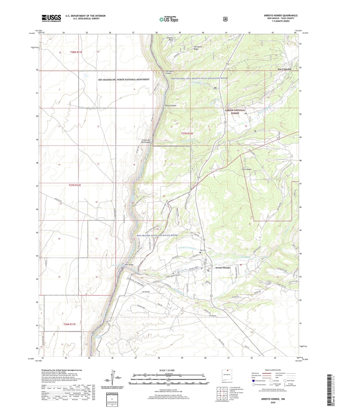
2023 topographic map quadrangle Arroyo Hondo in the state of New Mexico. Scale: 1:24000. Based on the newly updated USGS 7.5' US Topo map series, this map is in the following counties: Taos. The map contains contour data, water features, and other items you are used to seeing on USGS maps, but also has updated roads and other features. This is the next generation of topographic maps. Printed on high-quality waterproof paper with UV fade-resistant inks.
Quads adjacent to this one:
West: Cerro De Los Taoses
Northwest: Tres Piedras NE
North: Guadalupe Mountain
Northeast: Questa
East: Arroyo Seco
Southeast: Taos
South: Los Cordovas
Southwest: Tres Orejas
This map covers the same area as the classic USGS quad with code o36105e6.
Contains the following named places: Acequia de Atalaya, Arroyo Hondo, Arroyo Hondo Census Designated Place, Arroyo Hondo Elementary School, Arroyo Hondo Post Office, Canoncito, Cedar Springs, Cerro Negro, Cerros de Taos Ranch, Dunn Bridge, Garrapata Canyon, Hondo Seco Fire and Rescue Station 1, Horse Thief Shorty Rapid, House Water Well, Lady of Sorrows Church, Llano Ditch, Lobo Creek, Manby Hot Springs, New Buffalo Area, Ojitos Canyon, Parish School, Rael Cemetery, Rio Grande Wild River, Rio Hondo, San Cristobal, San Cristobal Census Designated Place, San Cristobal Creek, San Cristobal Post Office, South Water Well, Taos County, Turley Mill and Distillery Site, Van Bruggen Reservoir Dam, ZIP Codes: 87513, 87564