MyTopo
Tome NE New Mexico US Topo Map
Couldn't load pickup availability
Also explore the Tome NE Forest Service Topo of this same quad for updated USFS data
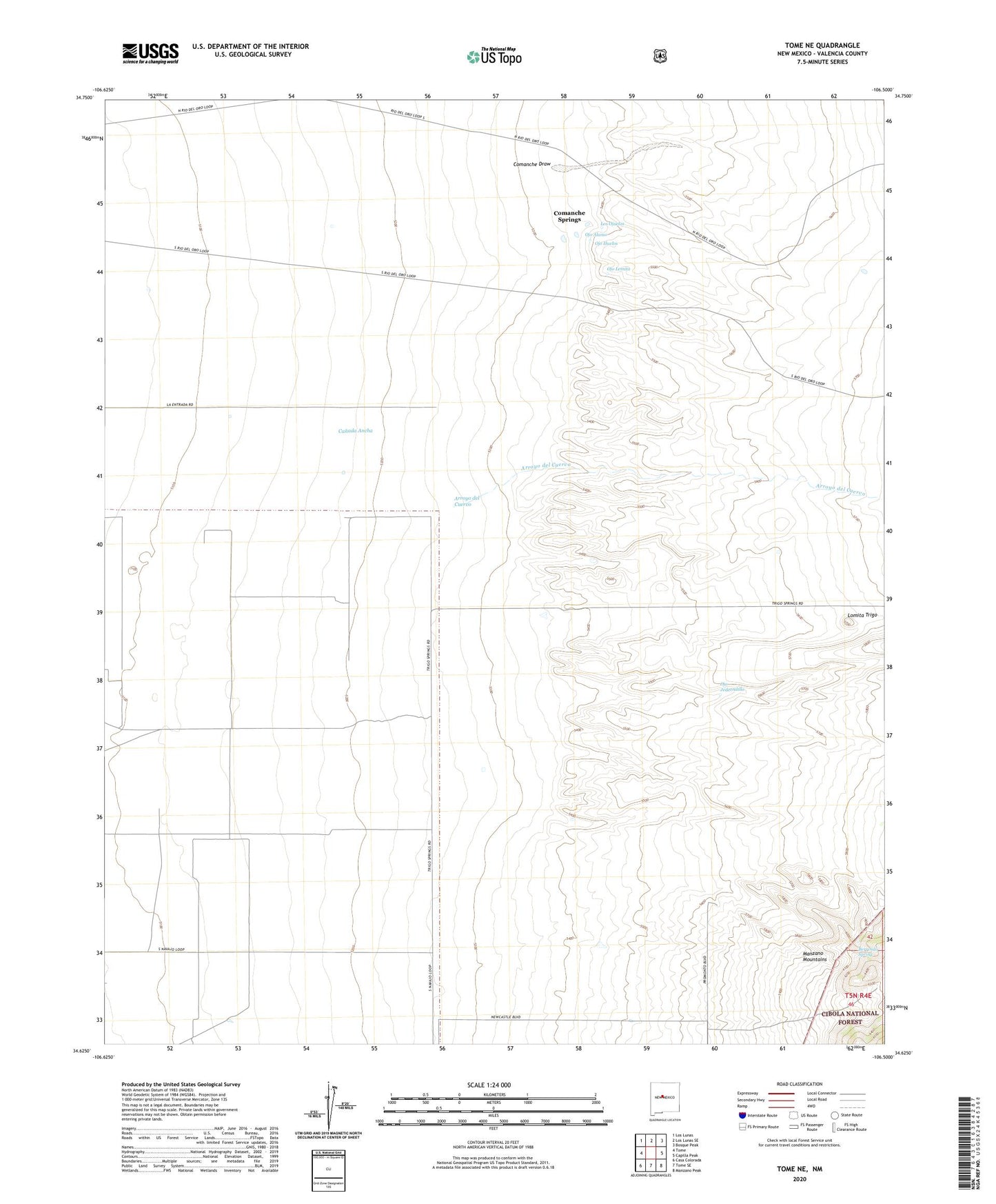
2023 topographic map quadrangle Tome NE in the state of New Mexico. Scale: 1:24000. Based on the newly updated USGS 7.5' US Topo map series, this map is in the following counties: Valencia. The map contains contour data, water features, and other items you are used to seeing on USGS maps, but also has updated roads and other features. This is the next generation of topographic maps. Printed on high-quality waterproof paper with UV fade-resistant inks.
Quads adjacent to this one:
West: Tome
Northwest: Los Lunas
North: Los Lunas SE
Northeast: Bosque Peak
East: Capilla Peak
Southeast: Manzano Peak
South: Tome SE
Southwest: Casa Colorada
This map covers the same area as the classic USGS quad with code o34106f5.
Contains the following named places: 10024 Water Well, Arroyo del Cuervo, Berrendo Spring, Canada Ancha, Comanche Draw, Comanche Springs, Lomita Trigo, Los Ojuelos, Ojo Alamo, Ojo Huelos, Ojo Jedeondilla, Ojo Lemita, Tome Grant