MyTopo
Los Pinos New Mexico US Topo Map
Couldn't load pickup availability
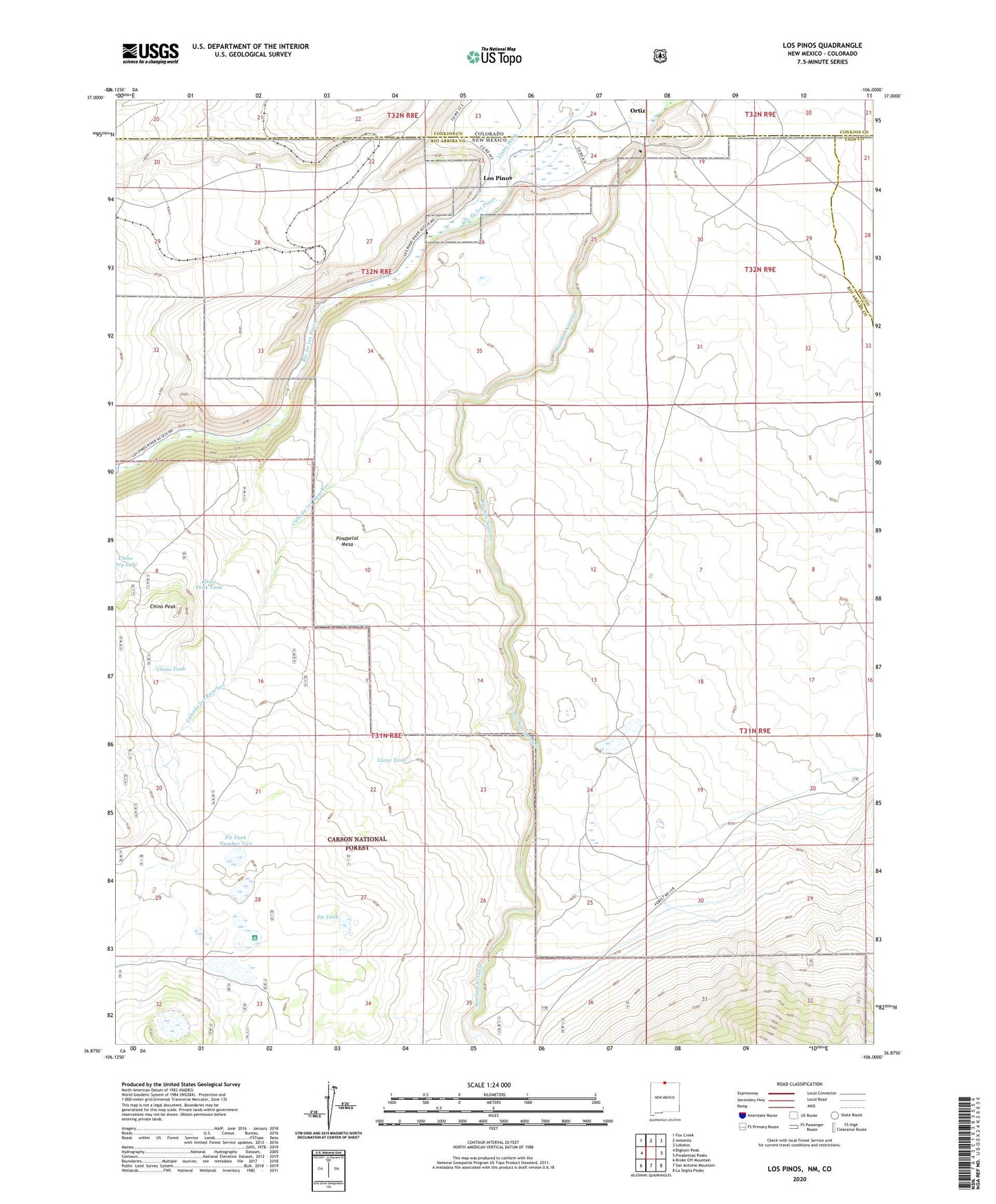
2020 topographic map quadrangle Los Pinos in the state of New Mexico. Scale: 1:24000. Based on the newly updated USGS 7.5' US Topo map series, this map is in the following counties: Rio Arriba, Conejos, Taos. The map contains contour data, water features, and other items you are used to seeing on USGS maps, but also has updated roads and other features. This is the next generation of topographic maps. Printed on high-quality waterproof paper with UV fade-resistant inks.
Quads adjacent to this one:
West: Bighorn Peak
Northwest: Fox Creek
North: Antonito
Northeast: Lobatos
East: Pinabetoso Peaks
Southeast: La Segita Peaks
South: San Antonio Mountain
Southwest: Broke Off Mountain
Contains the following named places: Big Horn Siding Rail Road Water Tank, Canada los Ranchos, Chino Peak, Chino Peak Tank, Chino Tank, Cisnero Mine Number One, Laguna Larga, Laguna Larga Camgpround, Lava, Lava Post Office, Llano Tank, Los Pinos, Pinabetal Mesa, Pit Tank, Pit Tank Number Three, Pit Tank Number Two, Rio de los Pinos, San Antonio Wilderness Study Area, T Bone Ranch