MyTopo
Antonito Colorado US Topo Map
Couldn't load pickup availability
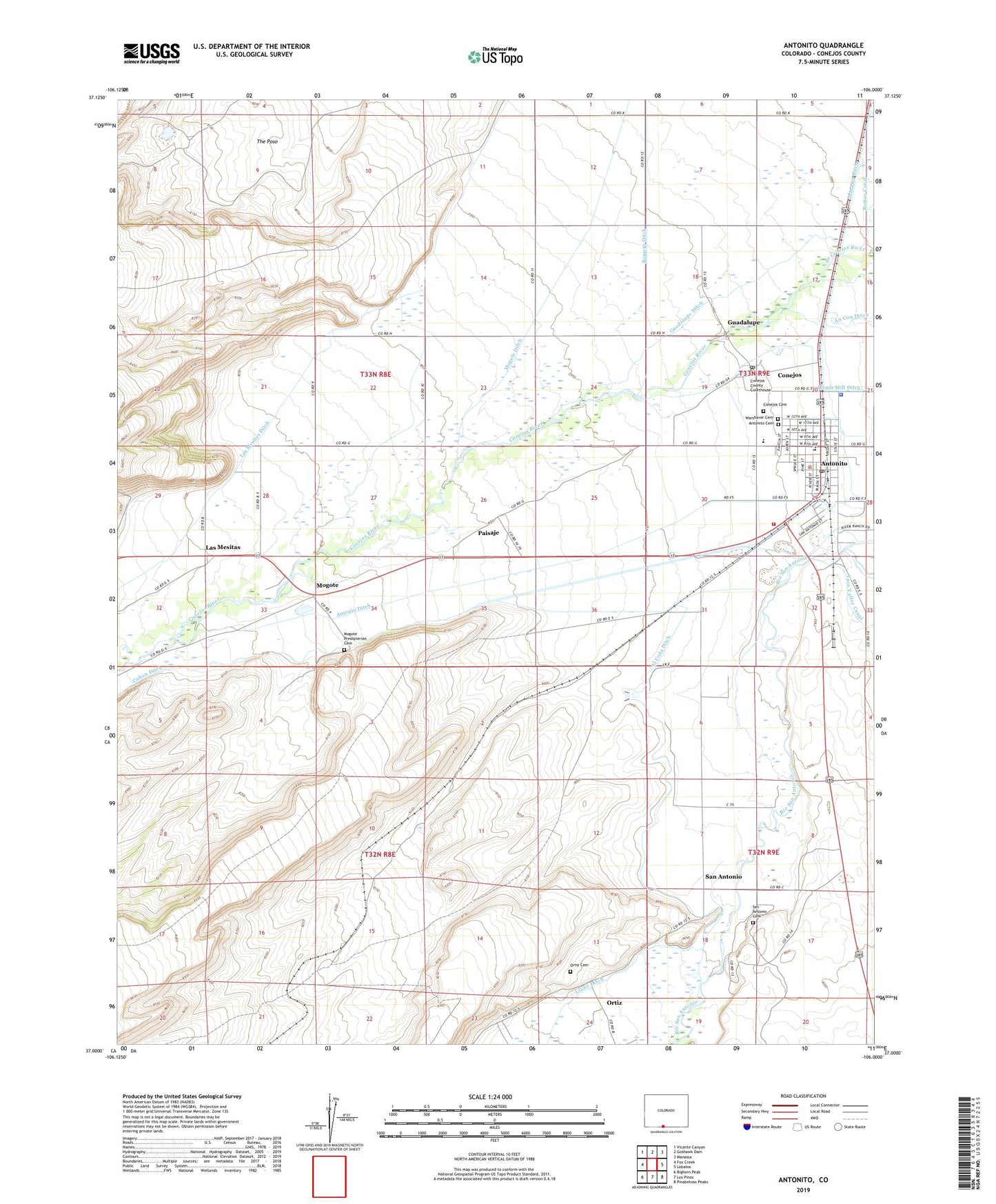
2022 topographic map quadrangle Antonito in the state of Colorado. Scale: 1:24000. Based on the newly updated USGS 7.5' US Topo map series, this map is in the following counties: Conejos. The map contains contour data, water features, and other items you are used to seeing on USGS maps, but also has updated roads and other features. This is the next generation of topographic maps. Printed on high-quality waterproof paper with UV fade-resistant inks.
Quads adjacent to this one:
West: Fox Creek
Northwest: Vicente Canyon
North: Goshawk Dam
Northeast: Manassa
East: Lobatos
Southeast: Pinabetoso Peaks
South: Los Pinos
Southwest: Bighorn Peak
This map covers the same area as the classic USGS quad with code o37106a1.
Contains the following named places: Antonito, Antonito Cemetery, Antonito Police Department, Antonito Post Office, Assembly of God Cristo El Rey, Bulldog Detention Dam, Canon Ditch, Conejos, Conejos Cemetery, Conejos Census Designated Place, Conejos County Sheriff's Office, Conejos Post Office, El Coda Ditch, Guadalupe, Guadalupe Ditch, Guadalupe Elementary School, Las Mesitas, Las Mesitas Ditch, Llano Ditch, Manassa Ditch, Mogote, Mogote Ditch, Mogote Presbyterian Cemetery, Ortiz, Ortiz Cemetery, Paisaje, Riprap Dam, San Antonio, San Antonio Cemetery, South Conejos Fire Protection District and Emergency Medical Services 1 Antonito Fire Department, The Poso, Town of Antonito, Warshaver Cemetery, ZIP Code: 81129