MyTopo
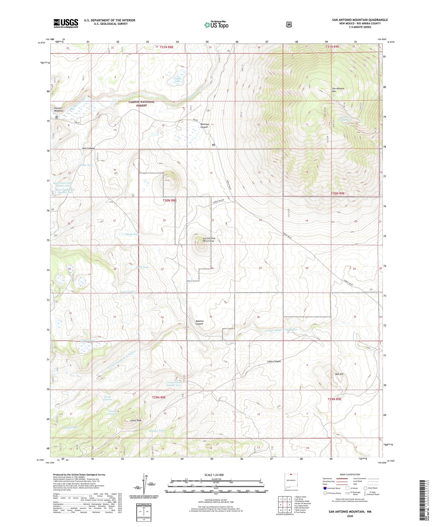
San Antonio Mountain New Mexico US Topo Map
Couldn't load pickup availability
Also explore the San Antonio Mountain Forest Service Topo of this same quad for updated USFS data
2023 topographic map quadrangle San Antonio Mountain in the state of New Mexico. Scale: 1:24000. Based on the newly updated USGS 7.5' US Topo map series, this map is in the following counties: Rio Arriba. The map contains contour data, water features, and other items you are used to seeing on USGS maps, but also has updated roads and other features. This is the next generation of topographic maps. Printed on high-quality waterproof paper with UV fade-resistant inks.
Quads adjacent to this one:
West: Broke Off Mountain
Northwest: Bighorn Peak
North: Los Pinos
Northeast: Pinabetoso Peaks
East: La Segita Peaks
Southeast: Tres Piedras
South: Mule Canyon
Southwest: Burned Mountain
This map covers the same area as the classic USGS quad with code o36106g1.
Contains the following named places: Aquaje Tank, Bean Patch Tank Number One, Bean Patch Tank Number Two, Cisneros Park, Corner Tank Number Two, Felipe Tank, Game Department Tank, Jara Canyon, Lamy Canyon, Lamy Peak, Los Cerritos De La Cruz, Lower San Antone Tank, Lucero Lakes, Lucero Tank, Malette Canyon, Meadow Tank, Montoya Canyon, North Cisneros, Pole Corral, Red Hill, Salin Tank, San Antonio Mountain, San Antonio Tank, South Cisneros, Stanley Tank, Stewart Corral, Ursulo Lake