MyTopo
Buckeye NE New Mexico US Topo Map
Couldn't load pickup availability
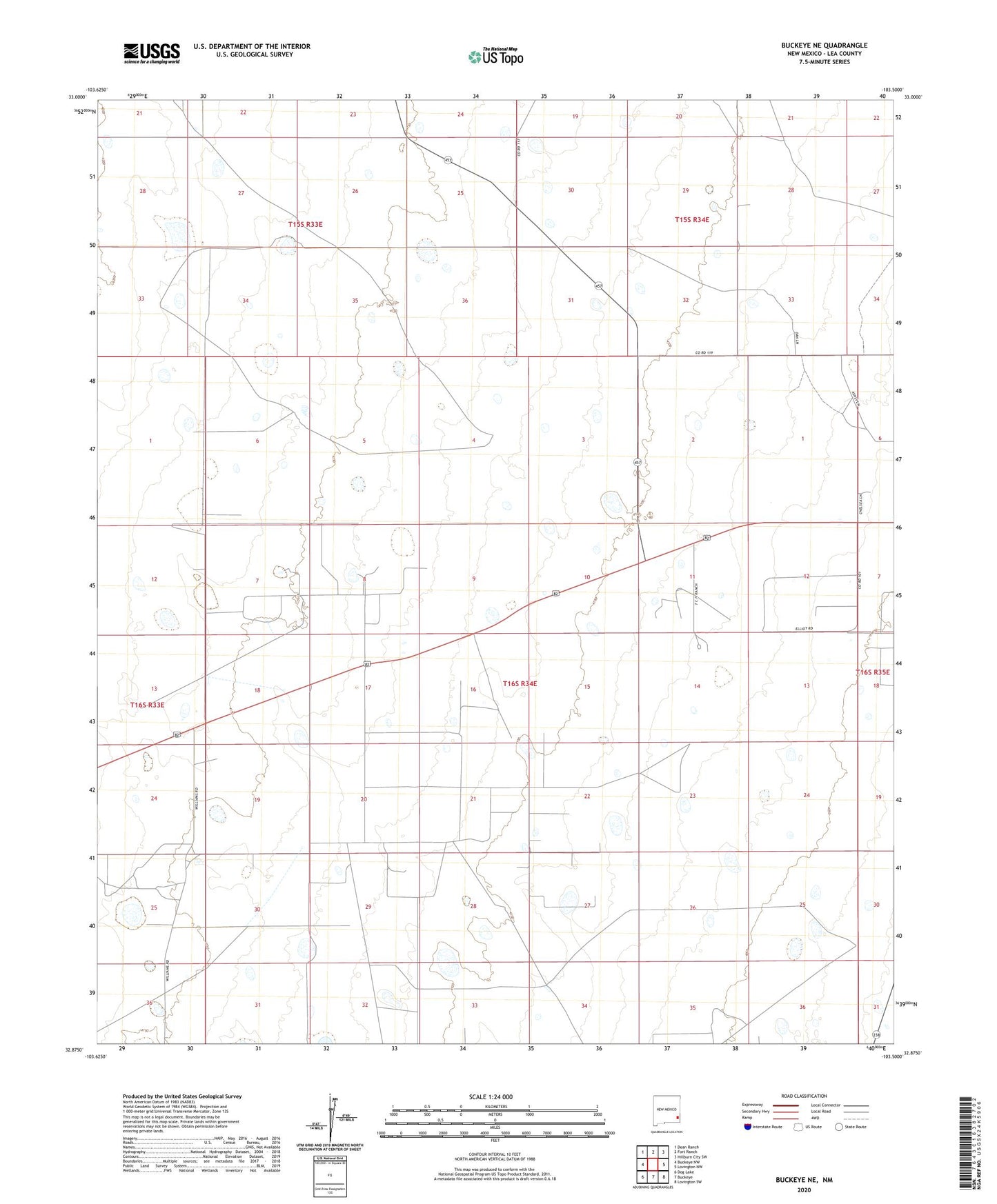
2023 topographic map quadrangle Buckeye NE in the state of New Mexico. Scale: 1:24000. Based on the newly updated USGS 7.5' US Topo map series, this map is in the following counties: Lea. The map contains contour data, water features, and other items you are used to seeing on USGS maps, but also has updated roads and other features. This is the next generation of topographic maps. Printed on high-quality waterproof paper with UV fade-resistant inks.
Quads adjacent to this one:
West: Buckeye NW
Northwest: Dean Ranch
North: Fort Ranch
Northeast: Hillburn City SW
East: Lovington NW
Southeast: Lovington SW
South: Buckeye
Southwest: Dog Lake
This map covers the same area as the classic USGS quad with code o32103h5.
Contains the following named places: 10158 Water Well, 10159 Water Well, 11070 Water Well, 11071 Water Well, 11080 Water Well, 11081 Water Well, 11082 Water Well, 11084 Water Well, 11086 Water Well, 11087 Water Well, 11088 Water Well, 11089 Water Well, 11090 Water Well, 11091 Water Well, 11092 Water Well, 11093 Water Well, 11094 Water Well, 11095 Water Well, 11096 Water Well, 11097 Water Well, 11098 Water Well, 11099 Water Well, 11100 Water Well, 11101 Water Well, 11102 Water Well, 11103 Water Well, 11105 Water Well, 11428 Water Well, 12391 Water Well, 12392 Water Well, 12393 Water Well, 12395 Water Well, 12414 Water Well, 12415 Water Well, 12416 Water Well, 12769 Water Well, 12858 Water Well, 12859 Water Well, 12860 Water Well, 13222 Water Well, 13307 Water Well, 13309 Water Well, 13310 Water Well, 13325 Water Well, 13331 Water Well, 13332 Water Well, 13333 Water Well, Chambers Sheep Camp, Clayton Ranch, East Windmill, Garrett Windmill, Hilburn Ranch, Hume Oil Field, Kemnitz Oil Field, Middle Well, York Ranch