MyTopo
Magdalena Peak New Mexico US Topo Map
Couldn't load pickup availability
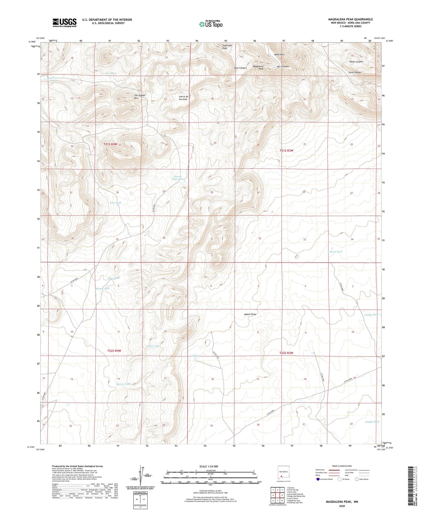
2020 topographic map quadrangle Magdalena Peak in the state of New Mexico. Scale: 1:24000. Based on the newly updated USGS 7.5' US Topo map series, this map is in the following counties: Doña Ana. The map contains contour data, water features, and other items you are used to seeing on USGS maps, but also has updated roads and other features. This is the next generation of topographic maps. Printed on high-quality waterproof paper with UV fade-resistant inks.
Quads adjacent to this one:
West: Good Sight Peak NE
Northwest: Hockett
North: Souse Springs
Northeast: Sierra Alta
East: Rough and Ready Hills
Southeast: Sleeping Lady Hills
South: Magdalena Gap
Southwest: Lazy E Ranch
Contains the following named places: Cahoon Tank, Carter Tank, East Tank, Kerr Tank, Little Mills Wells, Lone Tree Tank, Magdalena Peak, Manuel Tank, Martin Tank, Mesa Azur, Miguel Tanks, Monterey Well, New Tank, Shorty Swope Tank, Sierra de las Uvas, Swope Tank, Tajanio Pinto Tank, The Saddle Mountain, Twin Hills Tank, Upper Swope Tank, Vail Tank