MyTopo
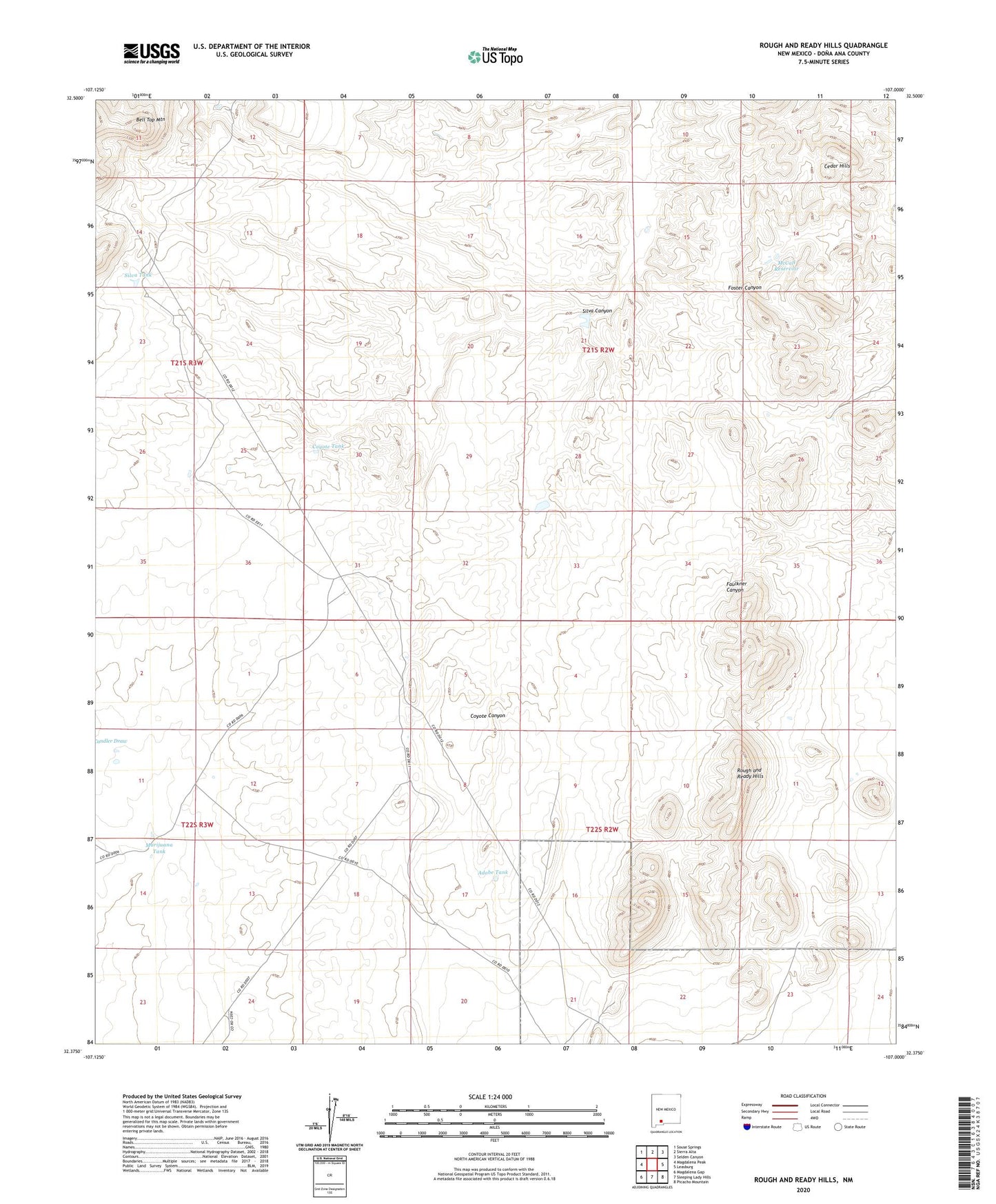
Rough and Ready Hills New Mexico US Topo Map
Couldn't load pickup availability
2023 topographic map quadrangle Rough and Ready Hills in the state of New Mexico. Scale: 1:24000. Based on the newly updated USGS 7.5' US Topo map series, this map is in the following counties: Doña Ana. The map contains contour data, water features, and other items you are used to seeing on USGS maps, but also has updated roads and other features. This is the next generation of topographic maps. Printed on high-quality waterproof paper with UV fade-resistant inks.
Quads adjacent to this one:
West: Magdalena Peak
Northwest: Souse Springs
North: Sierra Alta
Northeast: Selden Canyon
East: Leasburg
Southeast: Picacho Mountain
South: Sleeping Lady Hills
Southwest: Magdalena Gap
This map covers the same area as the classic USGS quad with code o32107d1.
Contains the following named places: Adobe Ranch, Adobe Ranch Water Well, Adobe Tank, Bell Top Mountain, Bill Shaw Tank, Cedar Hills, Coyote Tank, Las Uvas Number Five Dam, Las Uvas Number Four Dam, Las Uvas Number One Dam, Las Uvas Number Six Dam, Lloyd Well, Marijuana Tank, McCall Reservoir, NASA Luna Surveillance Station, Organ Mountains-Desert Peaks National Monument, Rough and Ready Hills, Silva Canyon, Silva Tank