
MyTopo
McCarty Ranch New Mexico US Topo Map
Couldn't load pickup availability
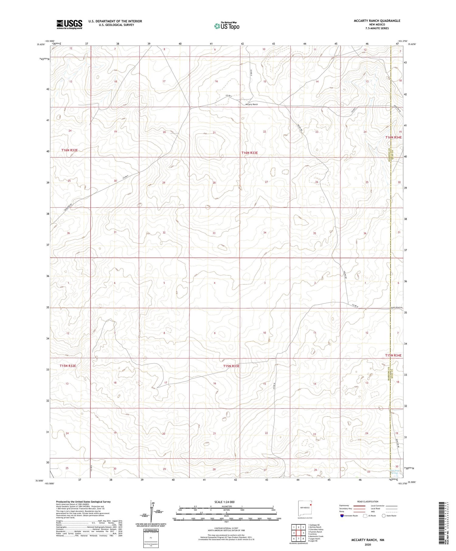
2020 topographic map quadrangle McCarty Ranch in the state of New Mexico. Scale: 1:24000. Based on the newly updated USGS 7.5' US Topo map series, this map is in the following counties: Harding, Quay. The map contains contour data, water features, and other items you are used to seeing on USGS maps, but also has updated roads and other features. This is the next generation of topographic maps. Printed on high-quality waterproof paper with UV fade-resistant inks.
Quads adjacent to this one:
West: Fuentes Ranch
Northwest: Gallegos NE
North: McCloy Ranch
Northeast: Cherokee Valley
East: Lockney
Southeast: Logan NE
South: Logan North
Southwest: Montesito Creek
Contains the following named places: 05288 Water Well, Basin Well, Bell Well, Brown North Well, Brown Place, Buck Well, Casados Well, Clay Well, East Sand Springs, East Well, Eclipse Well, Homestead Well, Jones North Well, Line Well, McCarty Ranch, McCartys, Mexican Well, Millin Draw Well, Mullin Well, New South Well, New Well, North Well, Sandy Well, South Orphan Well, South Well, Tom Young Well, Webster, West Key Well, Widow Well


