MyTopo
Mesquite Lake New Mexico US Topo Map
Couldn't load pickup availability
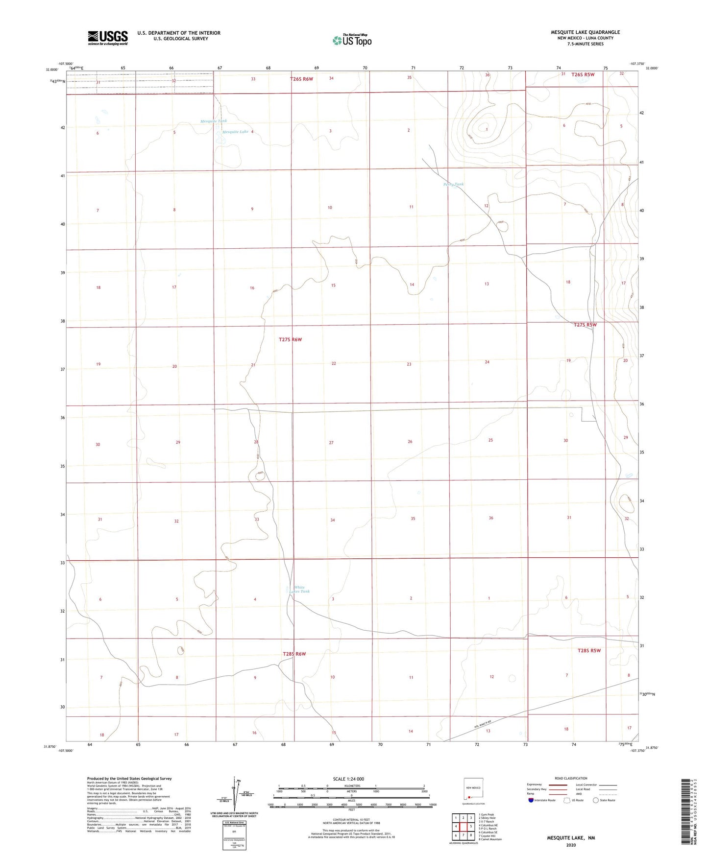
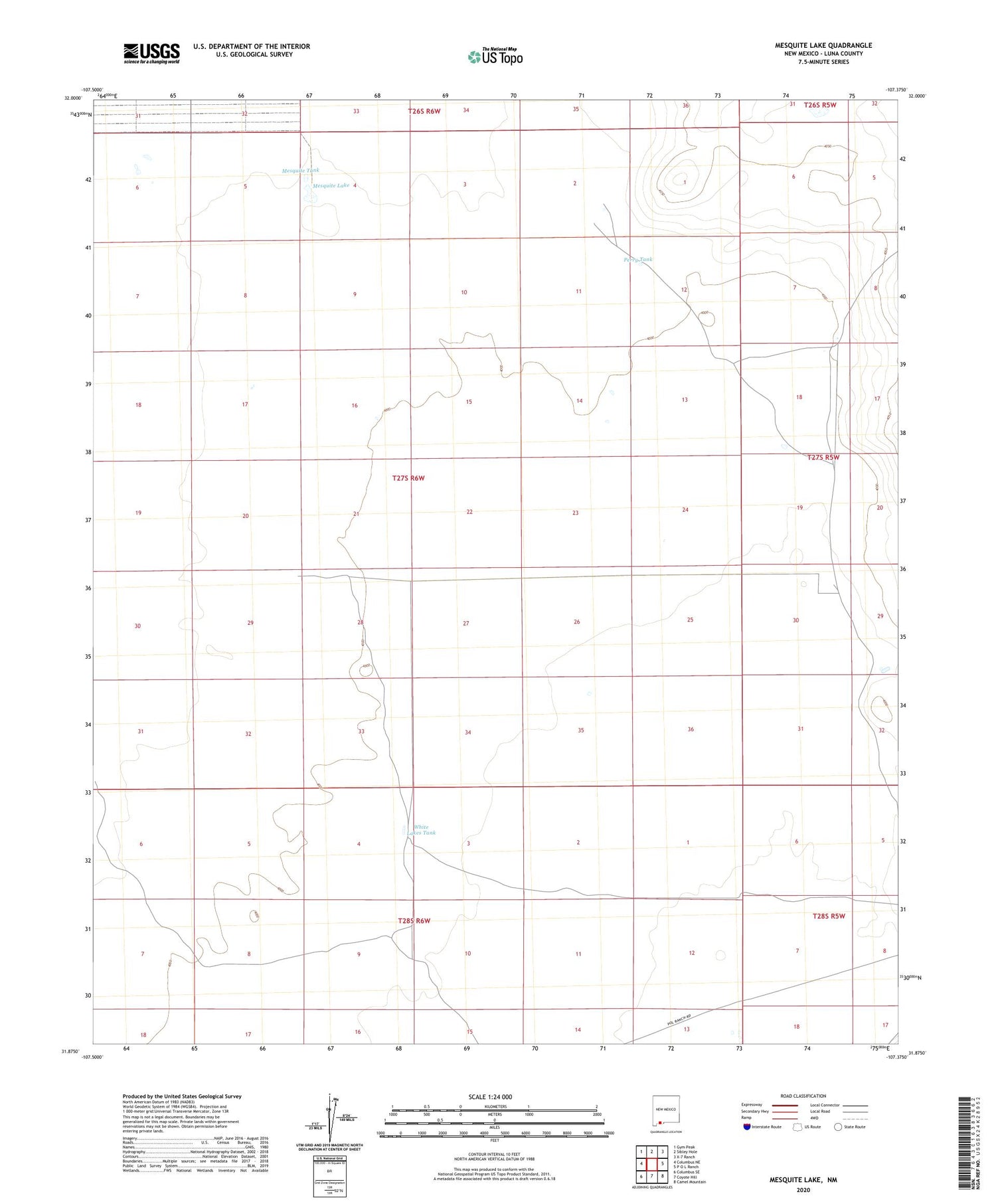
2020 topographic map quadrangle Mesquite Lake in the state of New Mexico. Scale: 1:24000. Based on the newly updated USGS 7.5' US Topo map series, this map is in the following counties: Luna. The map contains contour data, water features, and other items you are used to seeing on USGS maps, but also has updated roads and other features. This is the next generation of topographic maps. Printed on high-quality waterproof paper with UV fade-resistant inks.
Quads adjacent to this one:
West: Columbus NE
Northwest: Gym Peak
North: Sibley Hole
Northeast: X-7 Ranch
East: P O L Ranch
Southeast: Camel Mountain
South: Coyote Hill
Southwest: Columbus SE
Contains the following named places: 00871 Water Well, 00872 Water Well, 00874 Water Well, 00875 Water Well, 01024 Water Well, 01026 Water Well, 1025 Water Well, Cabin Well, Mesquite Lake, Mesquite Tank, Perry Tank, Ramon Windmill, Triangle Windmill, Twin Tanks, White Lakes Tank