MyTopo
Minnie Butte New Mexico US Topo Map
Couldn't load pickup availability
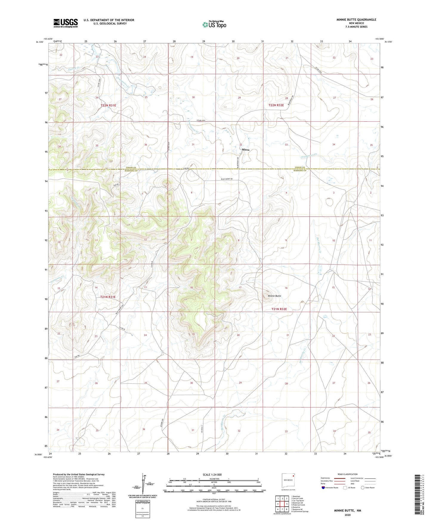
2020 topographic map quadrangle Minnie Butte in the state of New Mexico. Scale: 1:24000. Based on the newly updated USGS 7.5' US Topo map series, this map is in the following counties: Harding, Union. The map contains contour data, water features, and other items you are used to seeing on USGS maps, but also has updated roads and other features. This is the next generation of topographic maps. Printed on high-quality waterproof paper with UV fade-resistant inks.
Quads adjacent to this one:
West: Beenham SW
Northwest: Beenham
North: Garcia Creek
Northeast: Car Top Butte
East: Pedernal Creek
Southeast: Cottonwood Springs
South: Bueyeros NE
Southwest: Bueyeros
Contains the following named places: Amoco Number One State FE, Carbon Dioxide Number One Tinsley Mine, Church Creek, Jeffrey, Miera, Miera Church, Miera Post Office, Minnie Butte, Padilla, San Juan Batista Church Cemetery, Zarcillo Creek