MyTopo
Beenham SW New Mexico US Topo Map
Couldn't load pickup availability
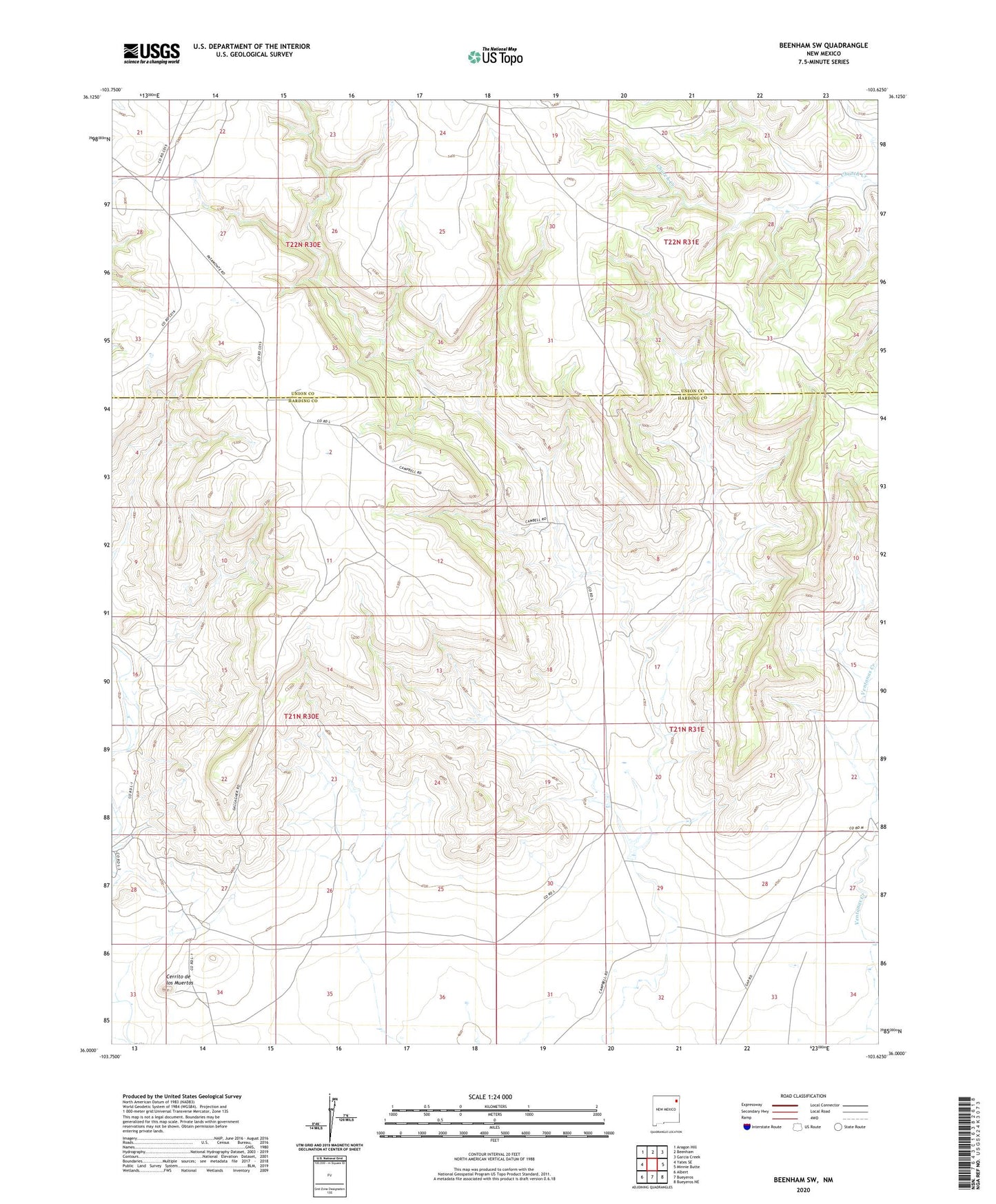
2023 topographic map quadrangle Beenham SW in the state of New Mexico. Scale: 1:24000. Based on the newly updated USGS 7.5' US Topo map series, this map is in the following counties: Harding, Union. The map contains contour data, water features, and other items you are used to seeing on USGS maps, but also has updated roads and other features. This is the next generation of topographic maps. Printed on high-quality waterproof paper with UV fade-resistant inks.
Quads adjacent to this one:
West: Yates SE
Northwest: Aragon Hill
North: Beenham
Northeast: Garcia Creek
East: Minnie Butte
Southeast: Bueyeros NE
South: Bueyeros
Southwest: Albert
This map covers the same area as the classic USGS quad with code o36103a6.
Contains the following named places: Adams Number Two Gonzales, Bueyeros CO2 Plant Airport, Campbell, Cerrito de los Muertos, Harlan Vigil, Neill Number One Stake, Powers Number One Timmons, Timmons, Timmons Number One Kerlin, Ventanas Creek