MyTopo
Bueyeros New Mexico US Topo Map
Couldn't load pickup availability
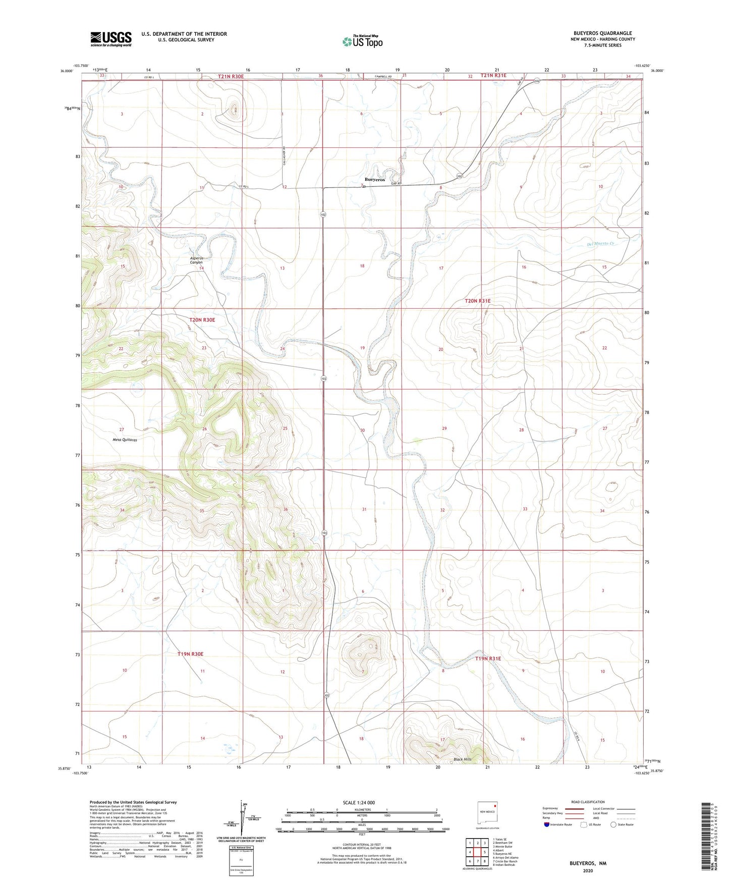
2023 topographic map quadrangle Bueyeros in the state of New Mexico. Scale: 1:24000. Based on the newly updated USGS 7.5' US Topo map series, this map is in the following counties: Harding. The map contains contour data, water features, and other items you are used to seeing on USGS maps, but also has updated roads and other features. This is the next generation of topographic maps. Printed on high-quality waterproof paper with UV fade-resistant inks.
Quads adjacent to this one:
West: Albert
Northwest: Yates SE
North: Beenham SW
Northeast: Minnie Butte
East: Bueyeros NE
Southeast: Indian Bathtub
South: Circle Bar Ranch
Southwest: Arroyo Del Alamo
This map covers the same area as the classic USGS quad with code o35103h6.
Contains the following named places: Alamocita Creek, American Prod Number One Bueye, Asperos Canyon, Bueyeros, Bueyeros Creek, Bueyeros Post Office, Bueyeros Weather Station, Colo Mex Number Two FC Debaca, Danube Number One Beller, Del Muerto Creek, Libby, Miera, Sacred Heart Church Historic Site, Salado Creek, Schwartz, Schwartz Number 1 X Libby, Schwartz Number Two Y Libby, Stinbaugh