MyTopo
Garcia Creek New Mexico US Topo Map
Couldn't load pickup availability
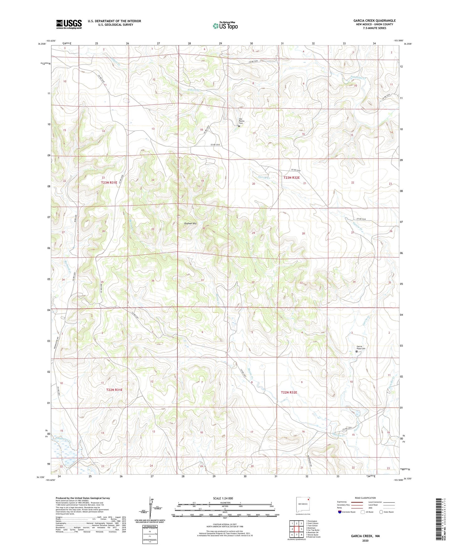
2023 topographic map quadrangle Garcia Creek in the state of New Mexico. Scale: 1:24000. Based on the newly updated USGS 7.5' US Topo map series, this map is in the following counties: Union. The map contains contour data, water features, and other items you are used to seeing on USGS maps, but also has updated roads and other features. This is the next generation of topographic maps. Printed on high-quality waterproof paper with UV fade-resistant inks.
Quads adjacent to this one:
West: Beenham
Northwest: Pennington
North: Goat Canyon
Northeast: Tate School
East: Car Top Butte
Southeast: Pedernal Creek
South: Minnie Butte
Southwest: Beenham SW
This map covers the same area as the classic USGS quad with code o36103b5.
Contains the following named places: Abbott Creek, Atchley, Blue Front Ranch, Carter, Garcia, Garcia Creek, Garcia Plaza Cemetery, Maples, Ojo Bonito Cemetery, Orphan Hill, Poling Erosion Control Dam, Poling Irrigation System Dam, Tramperos Creek Site One Dam, Tramperos Creek Site Two Dam, Walker