
MyTopo
Montoya New Mexico US Topo Map
Couldn't load pickup availability
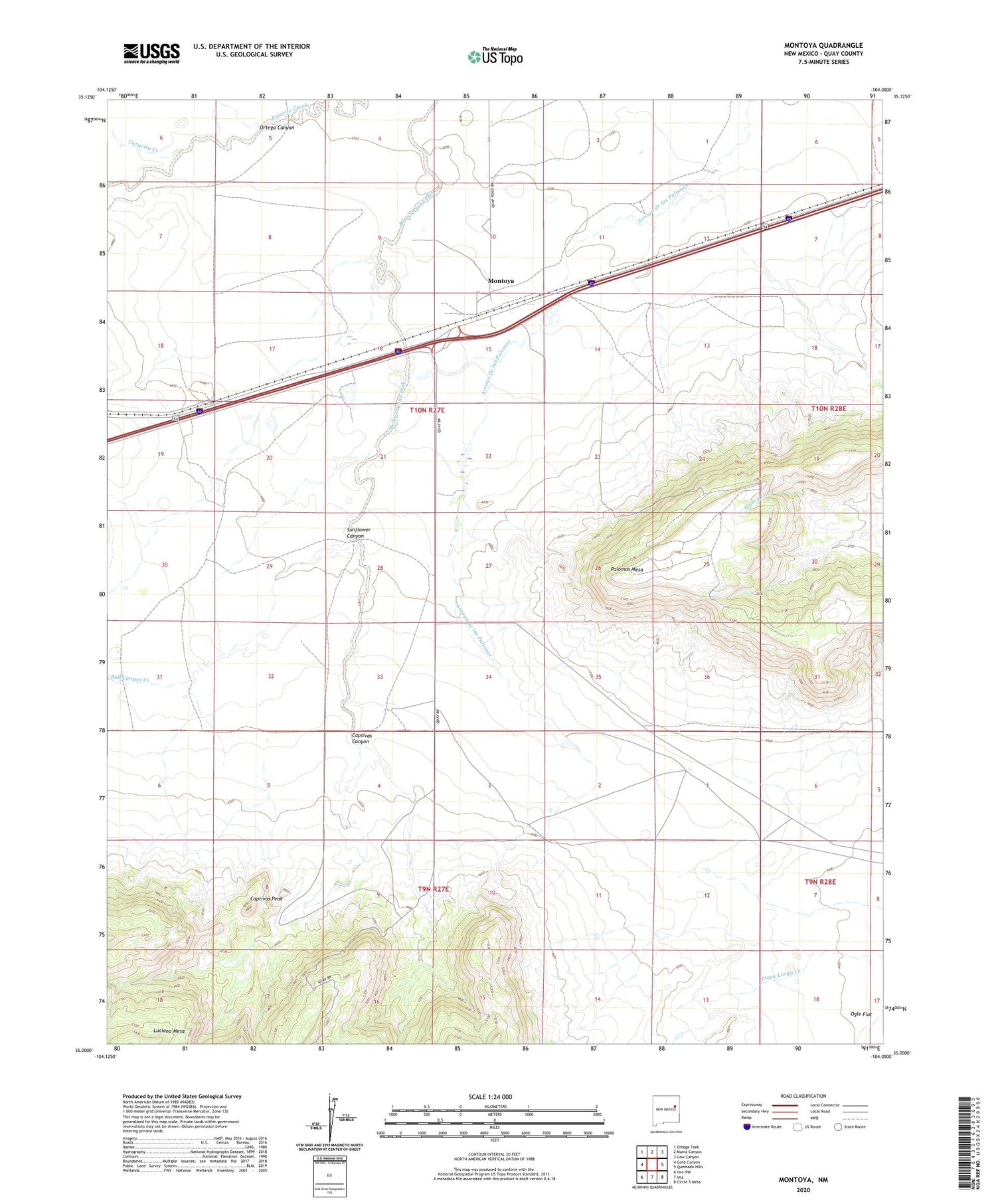
2020 topographic map quadrangle Montoya in the state of New Mexico. Scale: 1:24000. Based on the newly updated USGS 7.5' US Topo map series, this map is in the following counties: Quay, Guadalupe. The map contains contour data, water features, and other items you are used to seeing on USGS maps, but also has updated roads and other features. This is the next generation of topographic maps. Printed on high-quality waterproof paper with UV fade-resistant inks.
Quads adjacent to this one:
West: Gate Canyon
Northwest: Ortega Tank
North: Muniz Canyon
Northeast: Cow Canyon
East: Quemado Hills
Southeast: Circle S Mesa
South: Ima
Southwest: Ima NW
Contains the following named places: 05062 Water Well, 05063 Water Well, 05064 Water Well, 05065 Water Well, 05066 Water Well, 05067 Water Well, 05068 Water Well, 05069 Water Well, 05070 Water Well, 05071 Water Well, 05072 Water Well, Alires Windmill, Captivas Canyon, Captivas Peak, Caracita Creek, Caracita Windmill, Fish Pond Windmill, Headquarters Windmill, Horse Pasture Windmill, House Windmill, Juana de Darca Church, Kinkeed, Montoya, Montoya Post Office, Ortega Canyon, Palomas Mesa, Randal, Registered Windmill, Richardson Store, Salt Well Windmill, Sunflower Canyon, Weaning Pasture Windmill


