MyTopo
Cow Canyon New Mexico US Topo Map
Couldn't load pickup availability
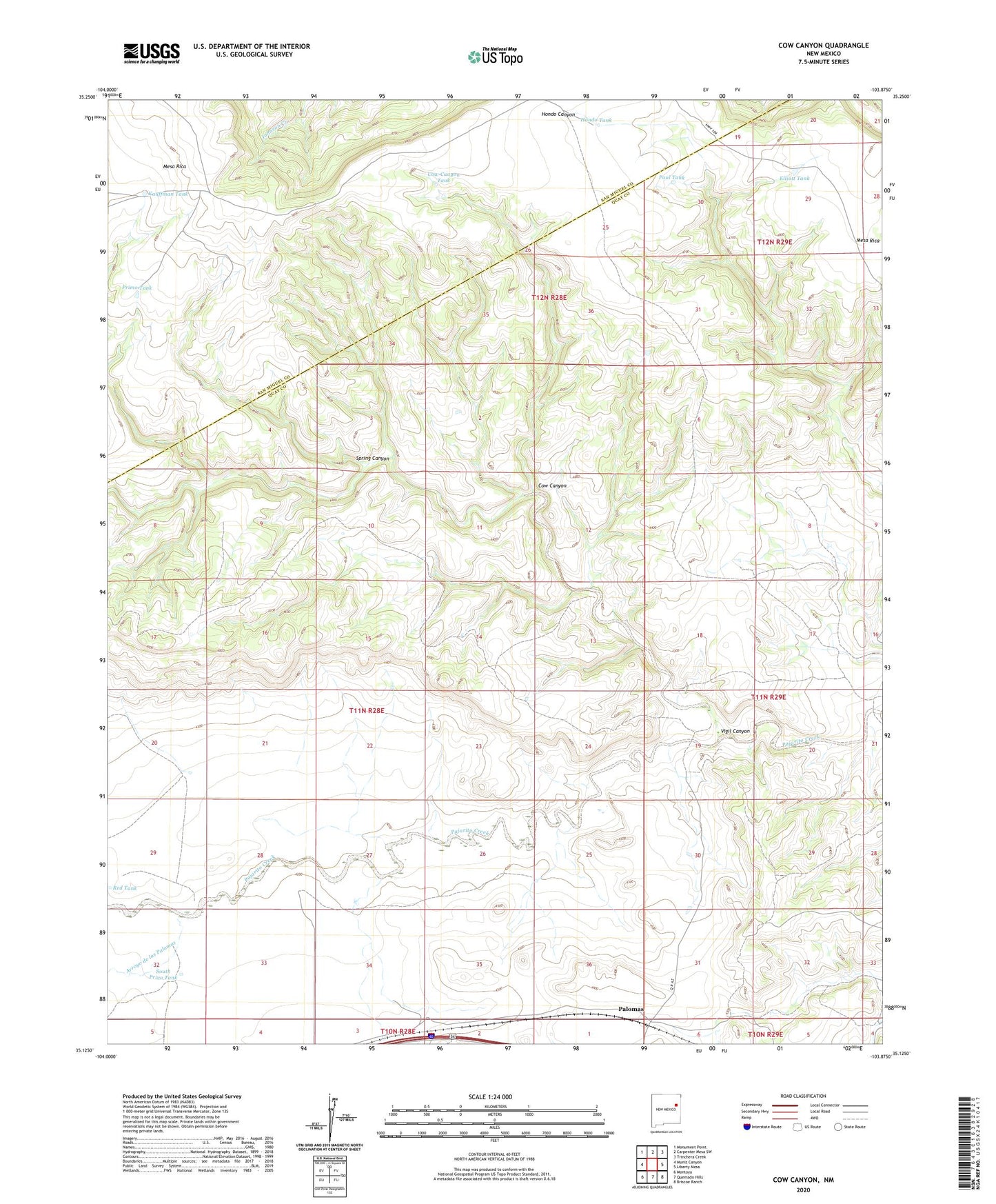
2023 topographic map quadrangle Cow Canyon in the state of New Mexico. Scale: 1:24000. Based on the newly updated USGS 7.5' US Topo map series, this map is in the following counties: Quay, San Miguel. The map contains contour data, water features, and other items you are used to seeing on USGS maps, but also has updated roads and other features. This is the next generation of topographic maps. Printed on high-quality waterproof paper with UV fade-resistant inks.
Quads adjacent to this one:
West: Muniz Canyon
Northwest: Monument Point
North: Carpenter Mesa SW
Northeast: Trinchera Creek
East: Liberty Mesa
Southeast: Briscoe Ranch
South: Quemado Hills
Southwest: Montoya
This map covers the same area as the classic USGS quad with code o35103b8.
Contains the following named places: 05085 Water Well, 10097 Water Well, 10106 Water Well, 10111 Water Well, 10114 Water Well, Arroyo de las Palomas, Cow Canyon, Cow Canyon Tank, Elliott Tank, Hanley, Hondo Tank, Kauffman Tank, North Privo Windmill, Palomas, Paul Tank, Primo Tank, Red Tank, South Privo Tank, South Privo Windmill, Spring Canyon, Spring Canyon Windmill, Vigil Canyon