MyTopo
Moses New Mexico US Topo Map
Couldn't load pickup availability
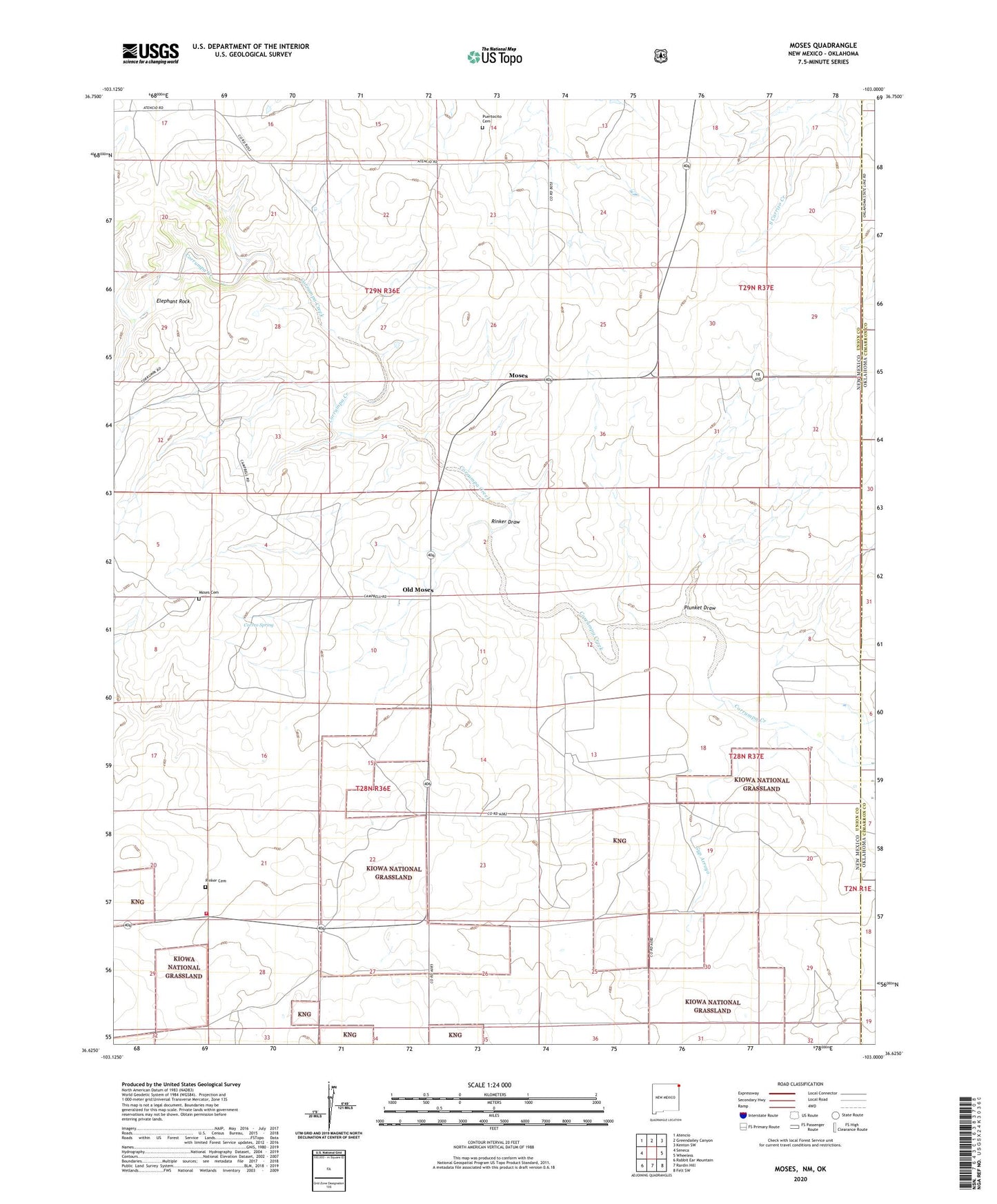
2020 topographic map quadrangle Moses in the state of New Mexico. Scale: 1:24000. Based on the newly updated USGS 7.5' US Topo map series, this map is in the following counties: Union, Cimarron. The map contains contour data, water features, and other items you are used to seeing on USGS maps, but also has updated roads and other features. This is the next generation of topographic maps. Printed on high-quality waterproof paper with UV fade-resistant inks.
Quads adjacent to this one:
West: Seneca
Northwest: Atencio
North: Greendailey Canyon
Northeast: Kenton SW
East: Wheeless
Southeast: Felt SW
South: Rardin Hill
Southwest: Rabbit Ear Mountain
Contains the following named places: Baker Cemetery, Correo Spring, Elephant Rock, Freeburg Windmill, Gyp Arroyo, Knowles School, Knowles Well, McNees Crossing, Monument Windmill, Moses, Moses Cemetery, Moses Post Office, Old Moses, Plunket Draw, Puertocito Cemetery, Rabbit Ear Fire Department Seneca Station, Rinker Cemetery, Rinker Draw, Wood Windmill