MyTopo
Mule Creek New Mexico US Topo Map
Couldn't load pickup availability
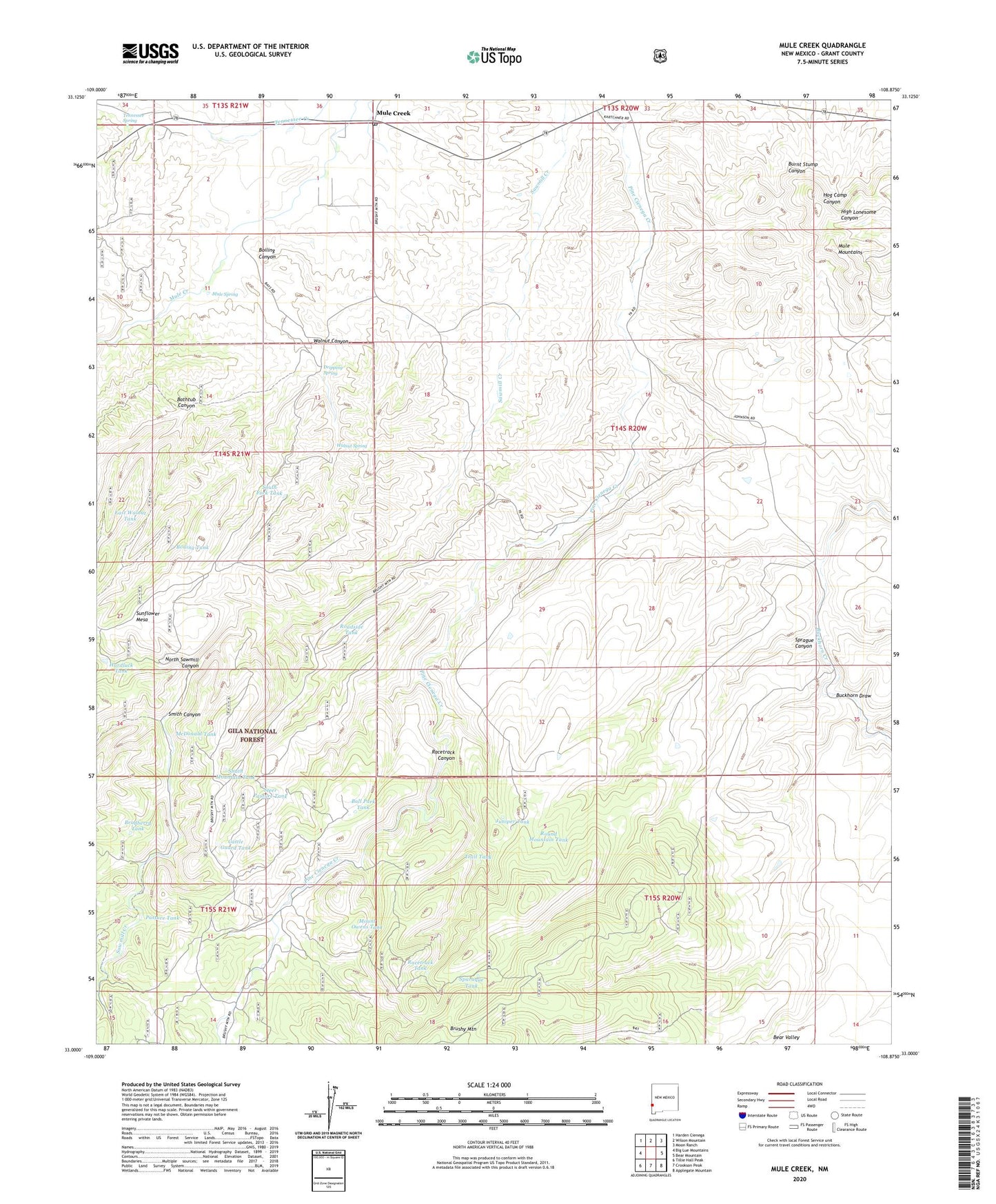
2020 topographic map quadrangle Mule Creek in the state of New Mexico. Scale: 1:24000. Based on the newly updated USGS 7.5' US Topo map series, this map is in the following counties: Grant. The map contains contour data, water features, and other items you are used to seeing on USGS maps, but also has updated roads and other features. This is the next generation of topographic maps. Printed on high-quality waterproof paper with UV fade-resistant inks.
Quads adjacent to this one:
West: Big Lue Mountains
Northwest: Harden Cienega
North: Wilson Mountain
Northeast: Moon Ranch
East: Bear Mountain
Southeast: Applegate Mountain
South: Crookson Peak
Southwest: Tillie Hall Peak
Contains the following named places: Ball Park Tank, Bastard Basin Tank, Bathtub Canyon, Boiling Canyon, Boiling Tank, Bradberry Tank, Buckhorn Draw, Cattle Guard Tank, Corner Tank, Dripping Spring, East Walnut Tank, East Wilkinson Tank, Hardluck Tank, Harkey Ranch, Hell Hole Wilderness Study Area, Johnson Tank, Juniper Tank, Larremore Ranch, McDonald Tank, Mount Owens Tank, Mule Creek, Mule Creek Post Office, Mule Creek Well, Mule Mountains, Mule Spring, North Sawmill Canyon, Pasture Tank, Racetrack Canyon, Racetrack Tank, Roadside Tank, Round Mountain Tank, Sawmill Well, Smith Canyon, Smith Mountain Tank, South Fork Tank, Sparaque Tank, Sprague Canyon, Steer Pasture Tank, Sunflower Mesa, Taylor Ranch, Tennessee Spring, Trail Tank, Walnut Canyon, Walnut Spring, Wilkinson Ranch, Wilkinson Tank, Y Six Ranch