MyTopo
Tillie Hall Peak New Mexico US Topo Map
Couldn't load pickup availability
Also explore the Tillie Hall Peak Forest Service Topo of this same quad for updated USFS data
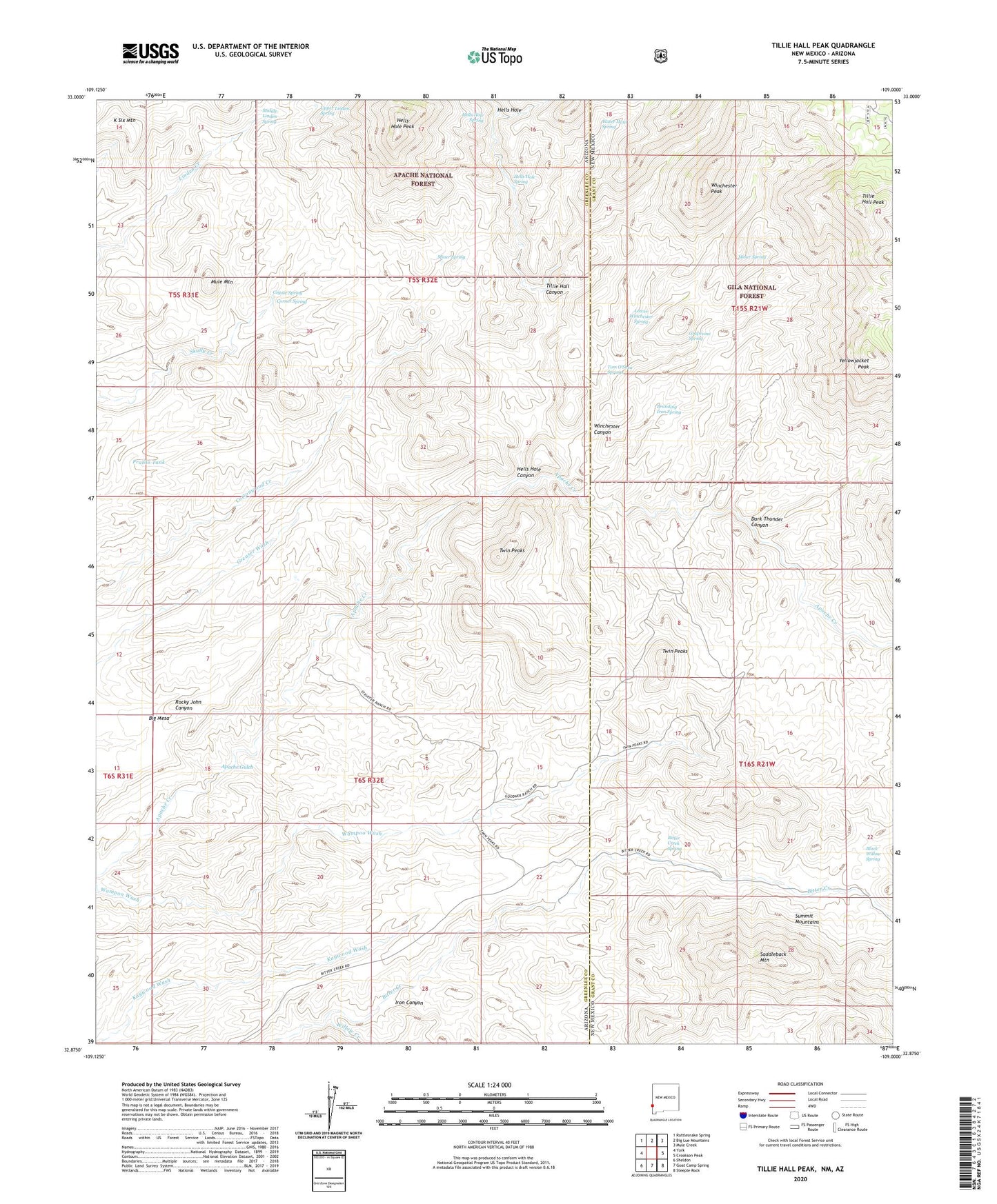
2023 topographic map quadrangle Tillie Hall Peak in the states of Arizona, New Mexico. Scale: 1:24000. Based on the newly updated USGS 7.5' US Topo map series, this map is in the following counties: Grant, Greenlee. The map contains contour data, water features, and other items you are used to seeing on USGS maps, but also has updated roads and other features. This is the next generation of topographic maps. Printed on high-quality waterproof paper with UV fade-resistant inks.
Quads adjacent to this one:
West: York
Northwest: Rattlesnake Spring
North: Big Lue Mountains
Northeast: Mule Creek
East: Crookson Peak
Southeast: Steeple Rock
South: Goat Camp Spring
Southwest: Sheldon
This map covers the same area as the classic USGS quad with code o32109h1.
Contains the following named places: Bitter Creek Spring, Black Willow Spring, Branding Iron Spring, Corner Spring, Corner Tank, Coyote Corral, Coyote Spring, Dark Thunder Canyon, Forest Boundary Corral, Four L Bar Ranch, Franks Tank, Grapevine Spring, Hells Hole, Hells Hole Canyon, Hells Hole Peak, Hells Hole Spring, Iron Canyon, Johnson Ranch, Leta Lynn Prospect, Lower Winchester Spring, Middle Linden Spring, Miner Spring, Mule Mountain, Saddleback Mountain, Skully Creek Ranch, Smith Ranch, Stateline Corral, Tillie Hall Canyon, Tillie Hall Peak, Tom O'Shea Springs, Tom Osher Springs, Twin Peaks, Twin Peaks Mine, Upper Linden Spring, Water Haul Spring, Willis Ranch, Willow Creek, Winchester Canyon, Winchester Peak, Yellowjacket Peak