MyTopo
Newman SW New Mexico US Topo Map
Couldn't load pickup availability
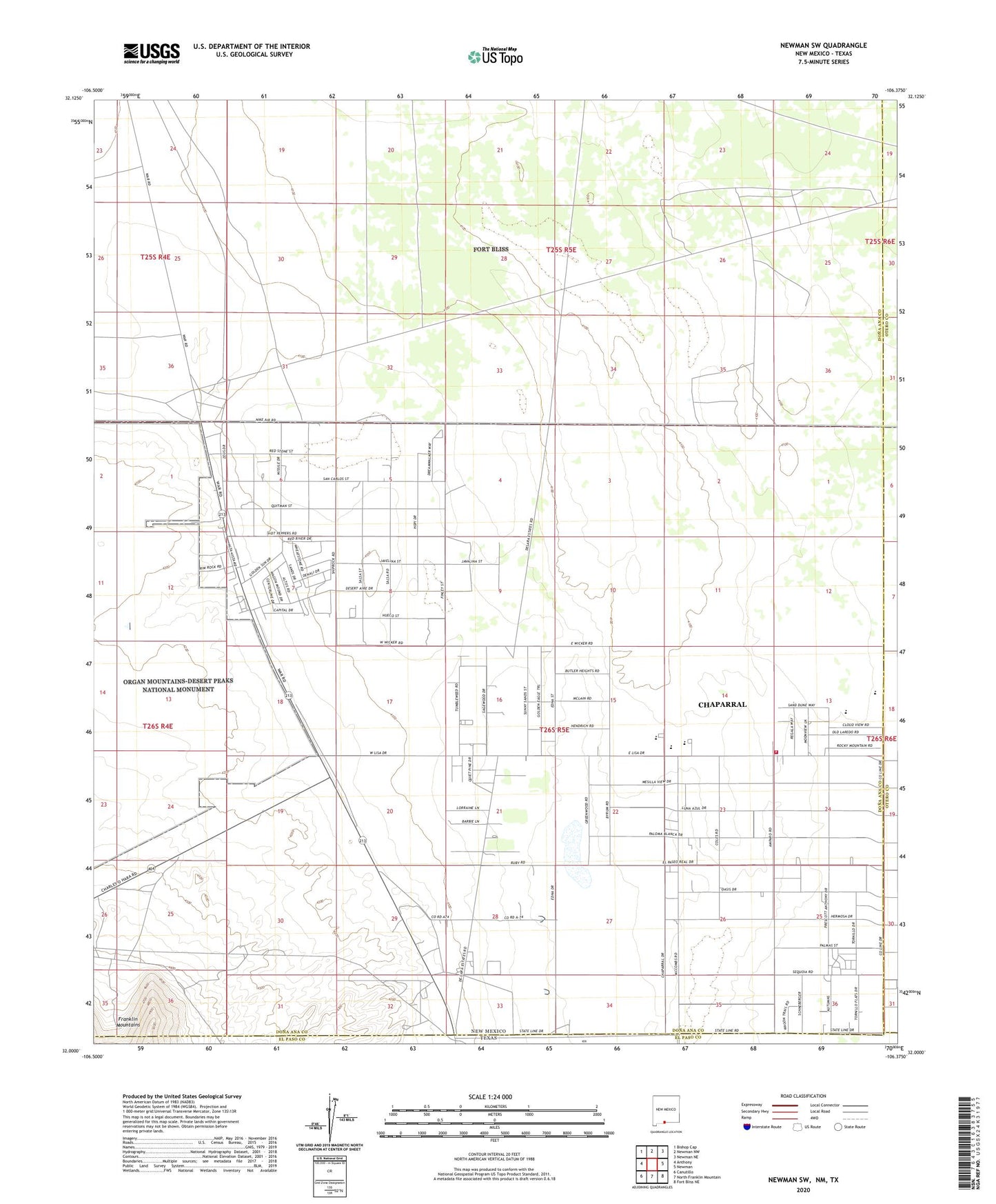
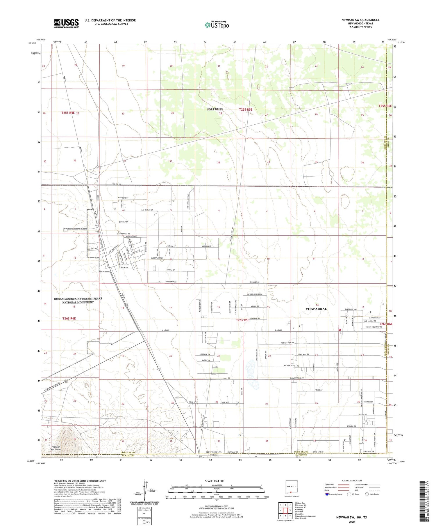
2020 topographic map quadrangle Newman SW in the state of New Mexico. Scale: 1:24000. Based on the newly updated USGS 7.5' US Topo map series, this map is in the following counties: Doña Ana, Otero, El Paso. The map contains contour data, water features, and other items you are used to seeing on USGS maps, but also has updated roads and other features. This is the next generation of topographic maps. Printed on high-quality waterproof paper with UV fade-resistant inks.
Quads adjacent to this one:
West: Anthony
Northwest: Bishop Cap
North: Newman NW
Northeast: Newman NE
East: Newman
Southeast: Fort Bliss NE
South: North Franklin Mountain
Southwest: Canutillo
Contains the following named places: Blythe Well, Chaparral, Chaparral Census Designated Place, Desert View Cemetery, Dona Ana County Fire Department - Station 9 Chaparral, Jessie Well, KZIA-TV (Las Cruces), Quirke Lake, Sand Tank, Tompkins Family Cemetery, Wessly Well