MyTopo
Nutt New Mexico US Topo Map
Couldn't load pickup availability
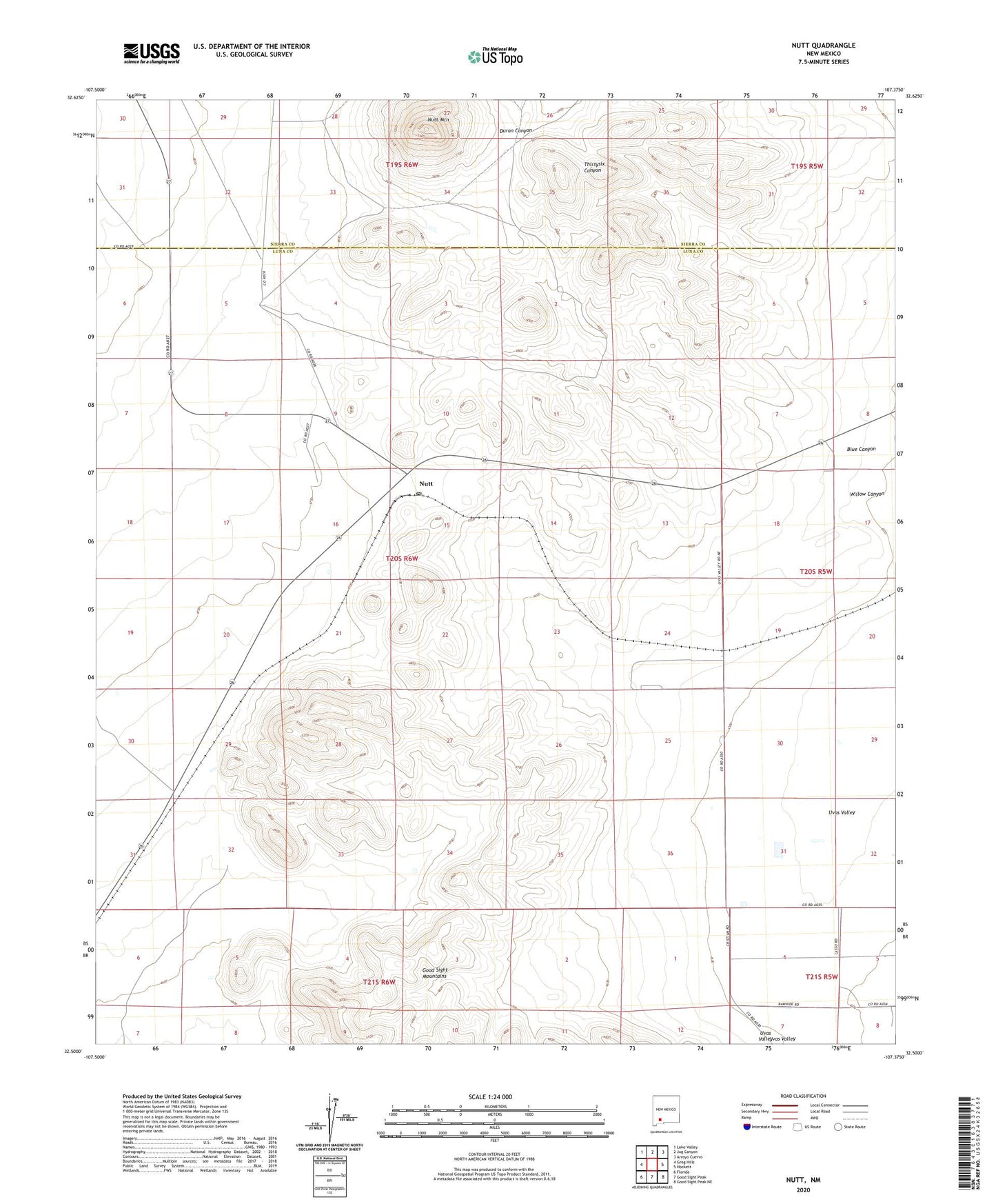
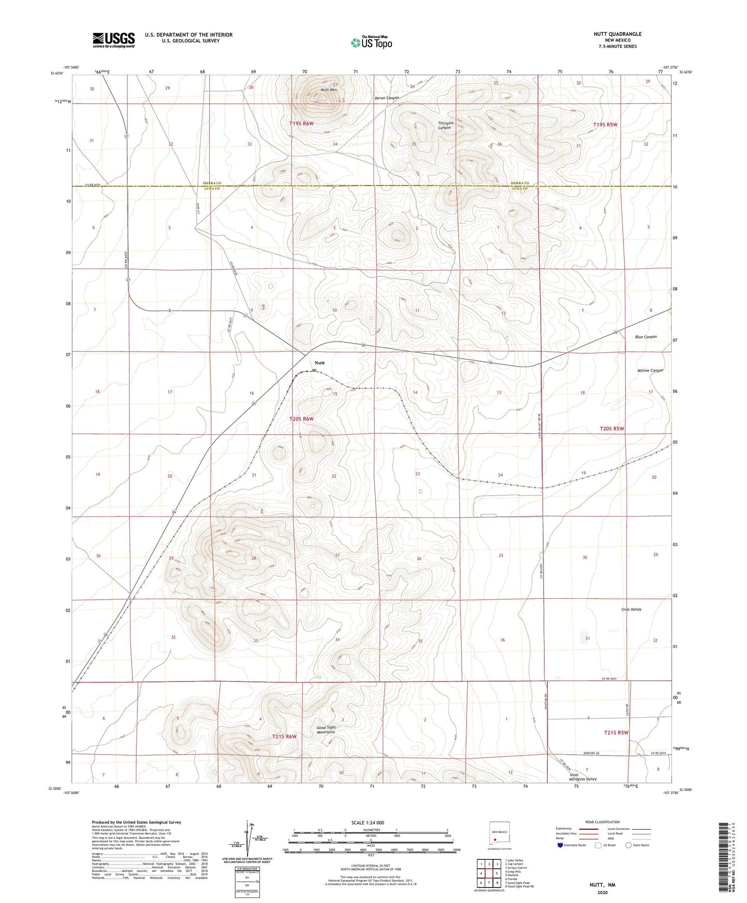
2020 topographic map quadrangle Nutt in the state of New Mexico. Scale: 1:24000. Based on the newly updated USGS 7.5' US Topo map series, this map is in the following counties: Luna, Sierra. The map contains contour data, water features, and other items you are used to seeing on USGS maps, but also has updated roads and other features. This is the next generation of topographic maps. Printed on high-quality waterproof paper with UV fade-resistant inks.
Quads adjacent to this one:
West: Greg Hills
Northwest: Lake Valley
North: Jug Canyon
Northeast: Arroyo Cuervo
East: Hockett
Southeast: Good Sight Peak NE
South: Good Sight Peak
Southwest: Florida
Contains the following named places: 01501 Water Well, 01502 Water Well, 01503 Water Well, 06155 Water Well, 10003 Water Well, 10004 Water Well, 10005 Water Well, 10011 Water Well, 10014 Water Well, 10446 Water Well, 10449 Water Well, 10454 Water Well, 10458 Water Well, 10459 Water Well, Blue Canyon, NH 121 Water Well, NH 160 Water Well, NH 83 Water Well, Nutt, Nutt Mountain, Nutt Post Office, Uvas Valley, Willow Canyon, Winder Ranch, Winder Stock Pens