MyTopo
Florida New Mexico US Topo Map
Couldn't load pickup availability
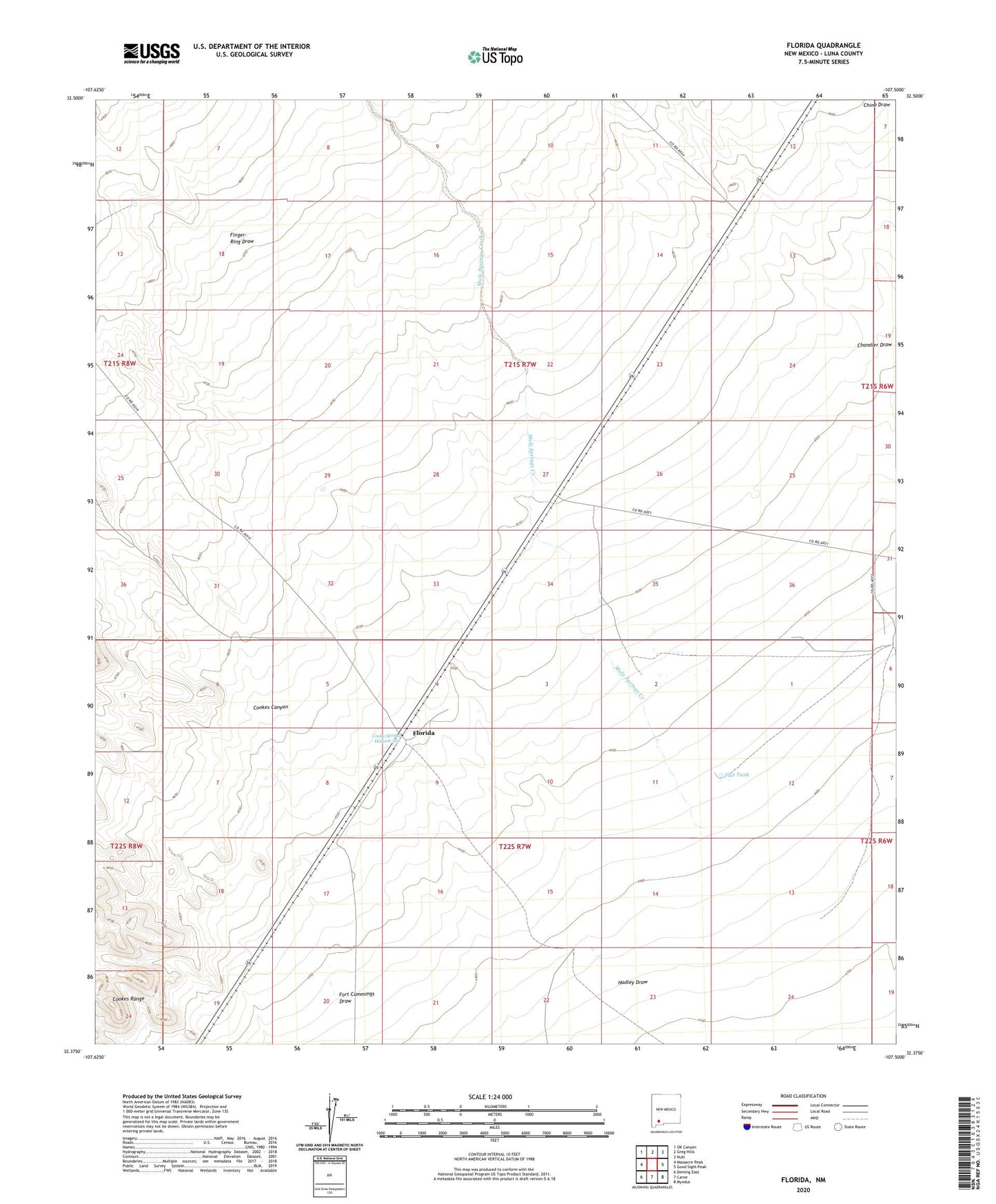
2023 topographic map quadrangle Florida in the state of New Mexico. Scale: 1:24000. Based on the newly updated USGS 7.5' US Topo map series, this map is in the following counties: Luna. The map contains contour data, water features, and other items you are used to seeing on USGS maps, but also has updated roads and other features. This is the next generation of topographic maps. Printed on high-quality waterproof paper with UV fade-resistant inks.
Quads adjacent to this one:
West: Massacre Peak
Northwest: OK Canyon
North: Greg Hills
Northeast: Nutt
East: Good Sight Peak
Southeast: Myndus
South: Carne
Southwest: Deming East
This map covers the same area as the classic USGS quad with code o32107d5.
Contains the following named places: 01207 Water Well, 01213 Water Well, 01214 Water Well, 01215 Water Well, 01217 Water Well, 01218 Water Well, 01276 Water Well, 01583 Water Well, 10468 Water Well, Britan Windmill, Cookes Canyon, Cooks Spring Historic Site, Dobies Windmill, Finger-Ring Draw, Flat Tank, Florida, Florida Post Office, Florida Weather Station, Fort Cummings Draw, Hadley Draw, Miller Windmill, Mule Springs Creek, Nunn Ranch