MyTopo
Lake Valley New Mexico US Topo Map
Couldn't load pickup availability
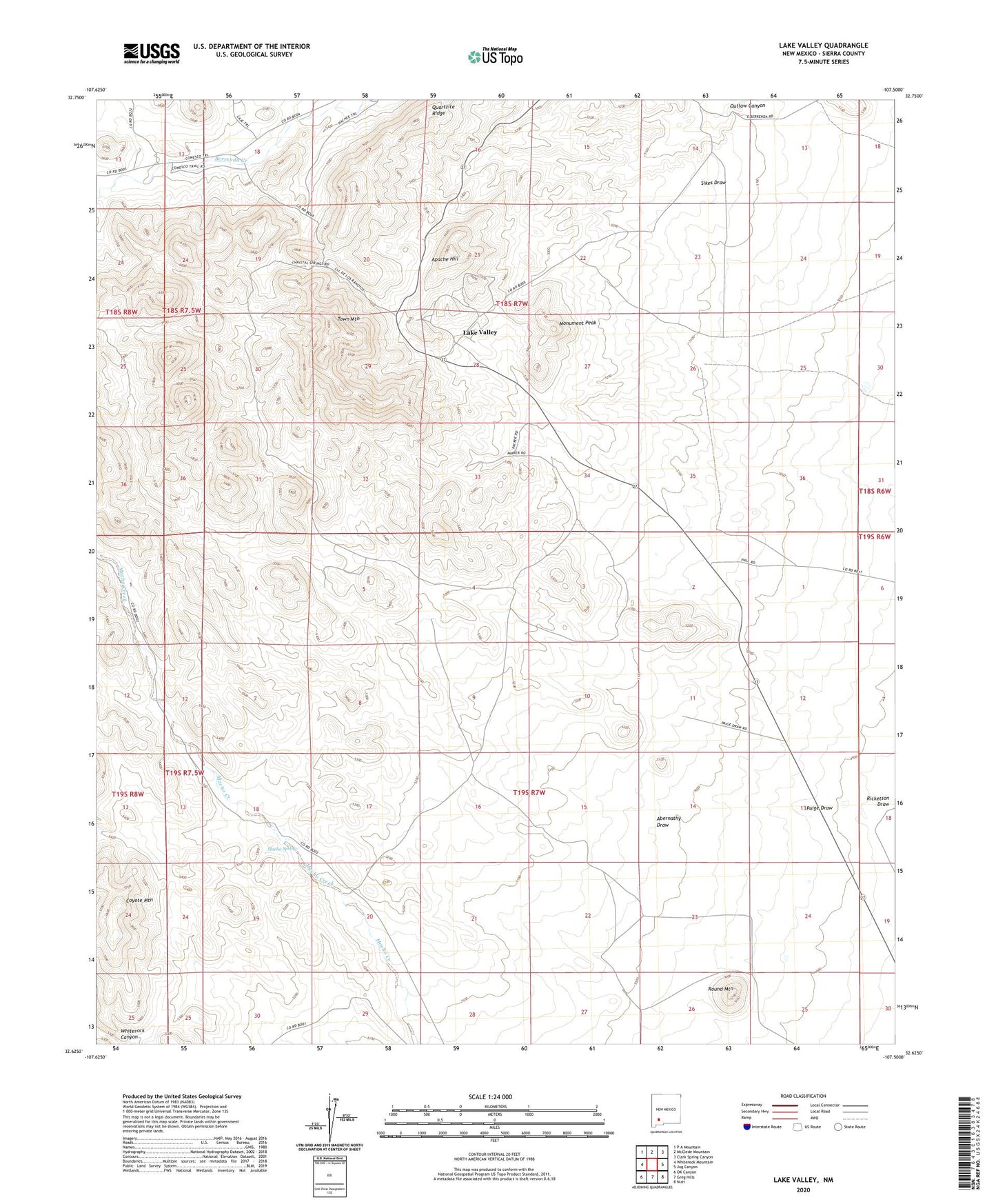
2023 topographic map quadrangle Lake Valley in the state of New Mexico. Scale: 1:24000. Based on the newly updated USGS 7.5' US Topo map series, this map is in the following counties: Sierra. The map contains contour data, water features, and other items you are used to seeing on USGS maps, but also has updated roads and other features. This is the next generation of topographic maps. Printed on high-quality waterproof paper with UV fade-resistant inks.
Quads adjacent to this one:
West: Whiterock Mountain
Northwest: P A Mountain
North: McClede Mountain
Northeast: Clark Spring Canyon
East: Jug Canyon
Southeast: Nutt
South: Greg Hills
Southwest: OK Canyon
This map covers the same area as the classic USGS quad with code o32107f5.
Contains the following named places: Abernathy Draw, Apache Hill, Booth, Bridal Chamber Mine, C McKinney Ranch, Coyote Mountain, De Muth Ranch, Dude Mine, Franks Ranch, Good Luck, Lake Valley, Lake Valley Cemetery, Lake Valley Mines Company, Lake Valley Post Office, Macho Spring, Monument Peak, Nunn Ranch, Oceola Well, Old Dude, Paige Draw, Phillips Ranch, Quartzite Ridge, Round Mountain, Sherman Well, Sierra Apache, Sierra Bella, Sierra Grande Mine, Town Mountain, Victory