MyTopo
Greg Hills New Mexico US Topo Map
Couldn't load pickup availability
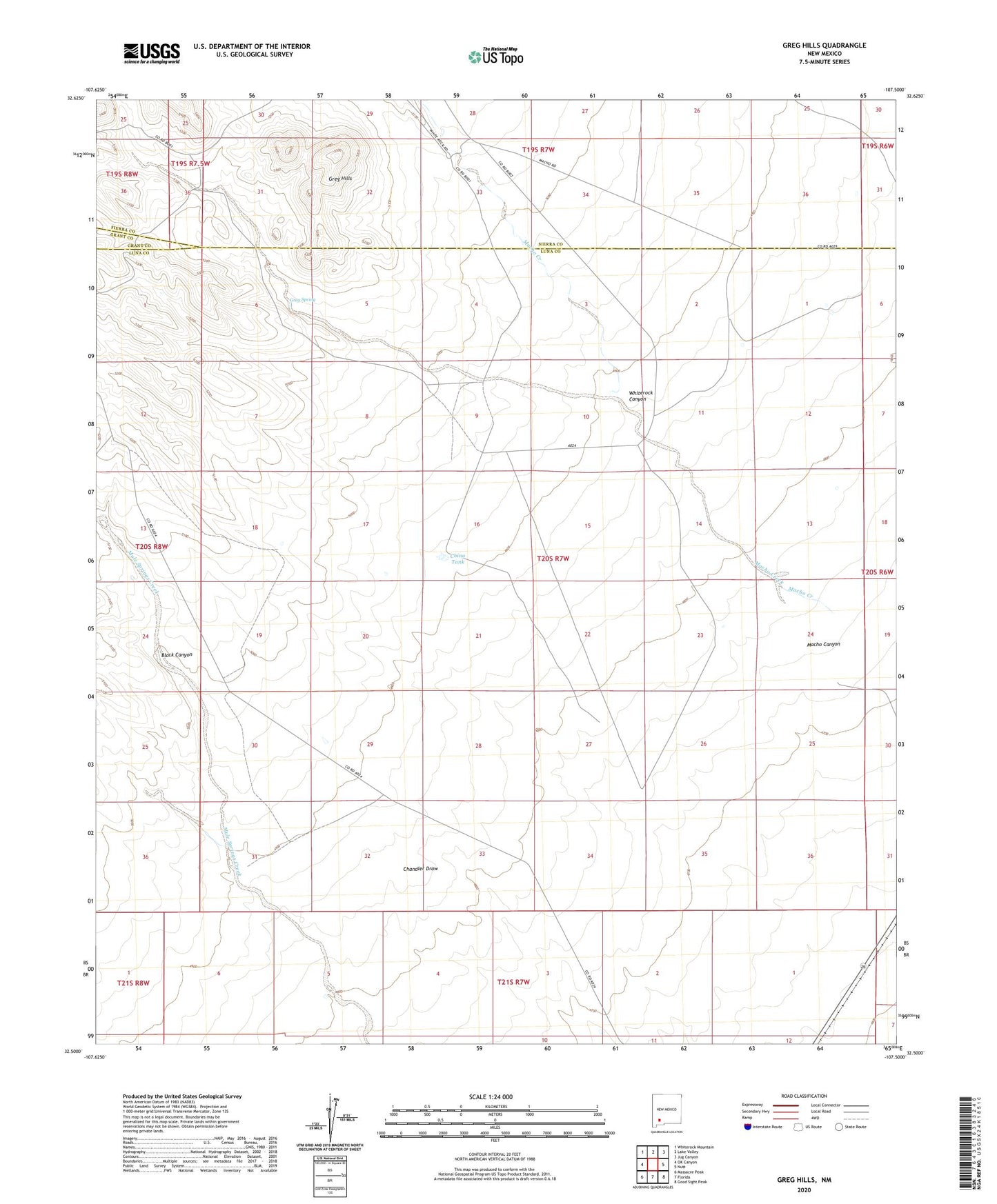
2023 topographic map quadrangle Greg Hills in the state of New Mexico. Scale: 1:24000. Based on the newly updated USGS 7.5' US Topo map series, this map is in the following counties: Luna, Sierra, Grant. The map contains contour data, water features, and other items you are used to seeing on USGS maps, but also has updated roads and other features. This is the next generation of topographic maps. Printed on high-quality waterproof paper with UV fade-resistant inks.
Quads adjacent to this one:
West: OK Canyon
Northwest: Whiterock Mountain
North: Lake Valley
Northeast: Jug Canyon
East: Nutt
Southeast: Good Sight Peak
South: Florida
Southwest: Massacre Peak
This map covers the same area as the classic USGS quad with code o32107e5.
Contains the following named places: 01273 Water Well, 06134 Water Well, Black Canyon, China Tank, Cotton Well, Graham Ranch, Greg Hills, Greg Spring, Macho Canyon, White Rock Ranch, Whiterock Canyon