MyTopo
Onava New Mexico US Topo Map
Couldn't load pickup availability
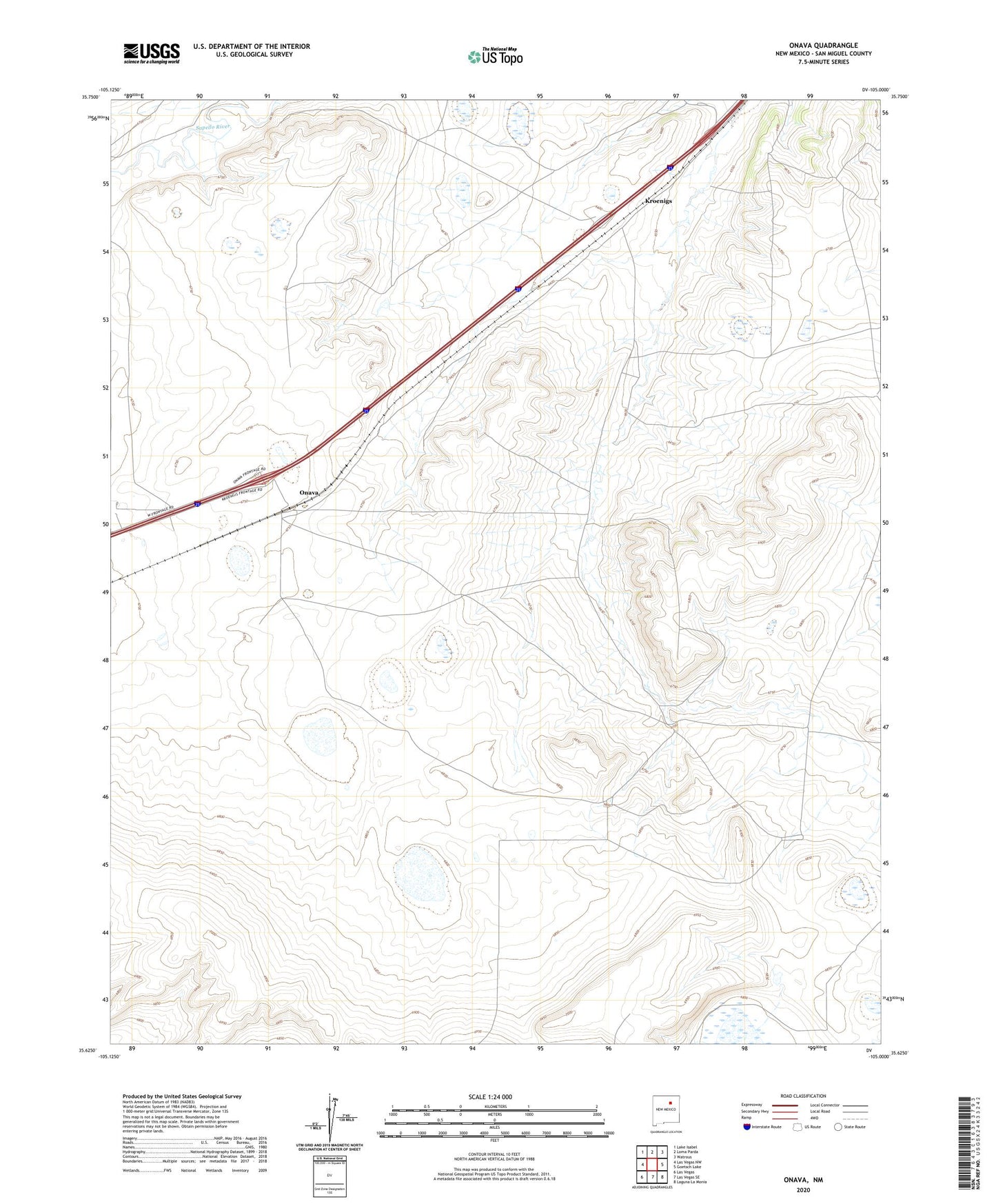
2020 topographic map quadrangle Onava in the state of New Mexico. Scale: 1:24000. Based on the newly updated USGS 7.5' US Topo map series, this map is in the following counties: San Miguel. The map contains contour data, water features, and other items you are used to seeing on USGS maps, but also has updated roads and other features. This is the next generation of topographic maps. Printed on high-quality waterproof paper with UV fade-resistant inks.
Quads adjacent to this one:
West: Las Vegas NW
Northwest: Lake Isabel
North: Loma Parda
Northeast: Watrous
East: Goetsch Lake
Southeast: Laguna La Monia
South: Las Vegas SE
Southwest: Las Vegas
Contains the following named places: Circle Ranch, Kroenigs, Old Santa Fe Trail, Onava, Onava Post Office, Onava Weather Station, Shoemaker Windmill, Walker Windmill