MyTopo
Las Vegas SE New Mexico US Topo Map
Couldn't load pickup availability
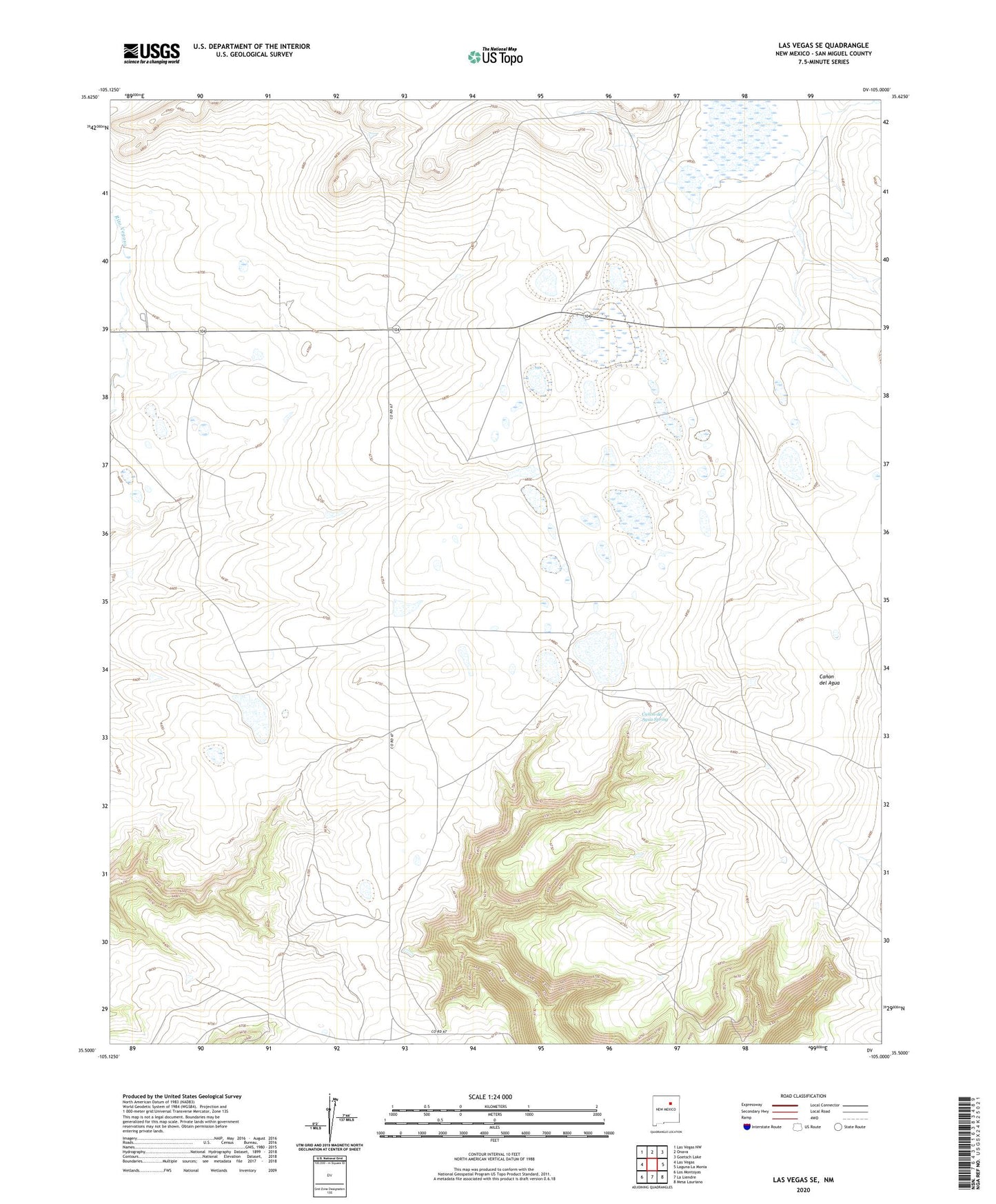
2023 topographic map quadrangle Las Vegas SE in the state of New Mexico. Scale: 1:24000. Based on the newly updated USGS 7.5' US Topo map series, this map is in the following counties: San Miguel. The map contains contour data, water features, and other items you are used to seeing on USGS maps, but also has updated roads and other features. This is the next generation of topographic maps. Printed on high-quality waterproof paper with UV fade-resistant inks.
Quads adjacent to this one:
West: Las Vegas
Northwest: Las Vegas NW
North: Onava
Northeast: Goetsch Lake
East: Laguna La Monia
Southeast: Mesa Lauriano
South: La Liendre
Southwest: Los Montoyas
This map covers the same area as the classic USGS quad with code o35105e1.
Contains the following named places: Belden Ranch, Canon del Agua Spring, Las Vegas Division, Las Vegas Grant, Leatherwood Ranch, Lewis Ranch, Spurlock Ranch