MyTopo
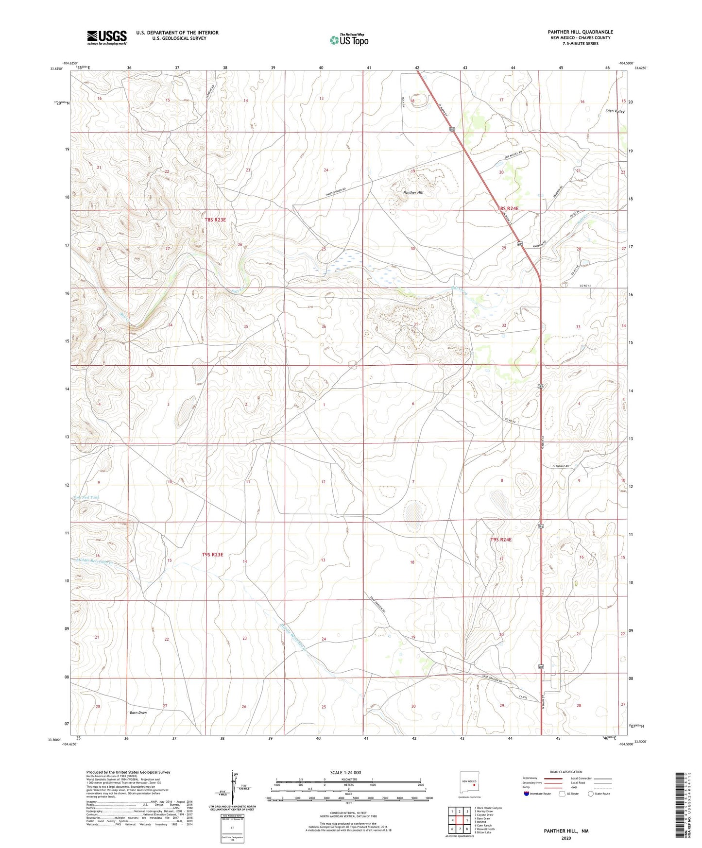
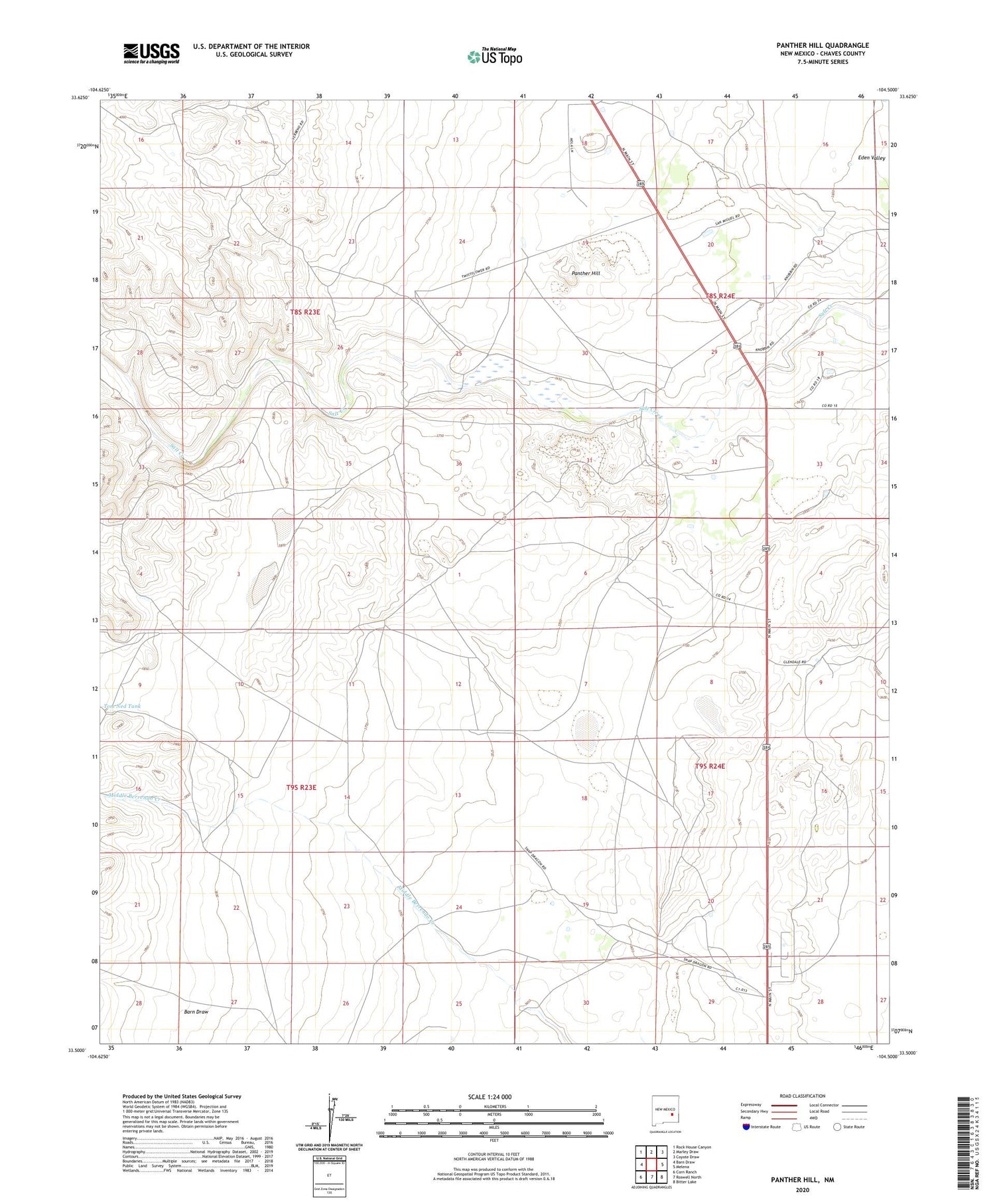
Panther Hill New Mexico US Topo Map
Couldn't load pickup availability
2020 topographic map quadrangle Panther Hill in the state of New Mexico. Scale: 1:24000. Based on the newly updated USGS 7.5' US Topo map series, this map is in the following counties: Chaves. The map contains contour data, water features, and other items you are used to seeing on USGS maps, but also has updated roads and other features. This is the next generation of topographic maps. Printed on high-quality waterproof paper with UV fade-resistant inks.
Quads adjacent to this one:
West: Barn Draw
Northwest: Rock House Canyon
North: Marley Draw
Northeast: Coyote Draw
East: Melena
Southeast: Bitter Lake
South: Roswell North
Southwest: Corn Ranch
Contains the following named places: Barn Draw, Butler Windmill, Dr Robert Goddard Original Rocket Tower Site, Eden Valley, Panther Hill, Panther Windmill, Salt Creek Church, Toltec Record Well, Tom Ned Tank