MyTopo
Coyote Draw New Mexico US Topo Map
Couldn't load pickup availability
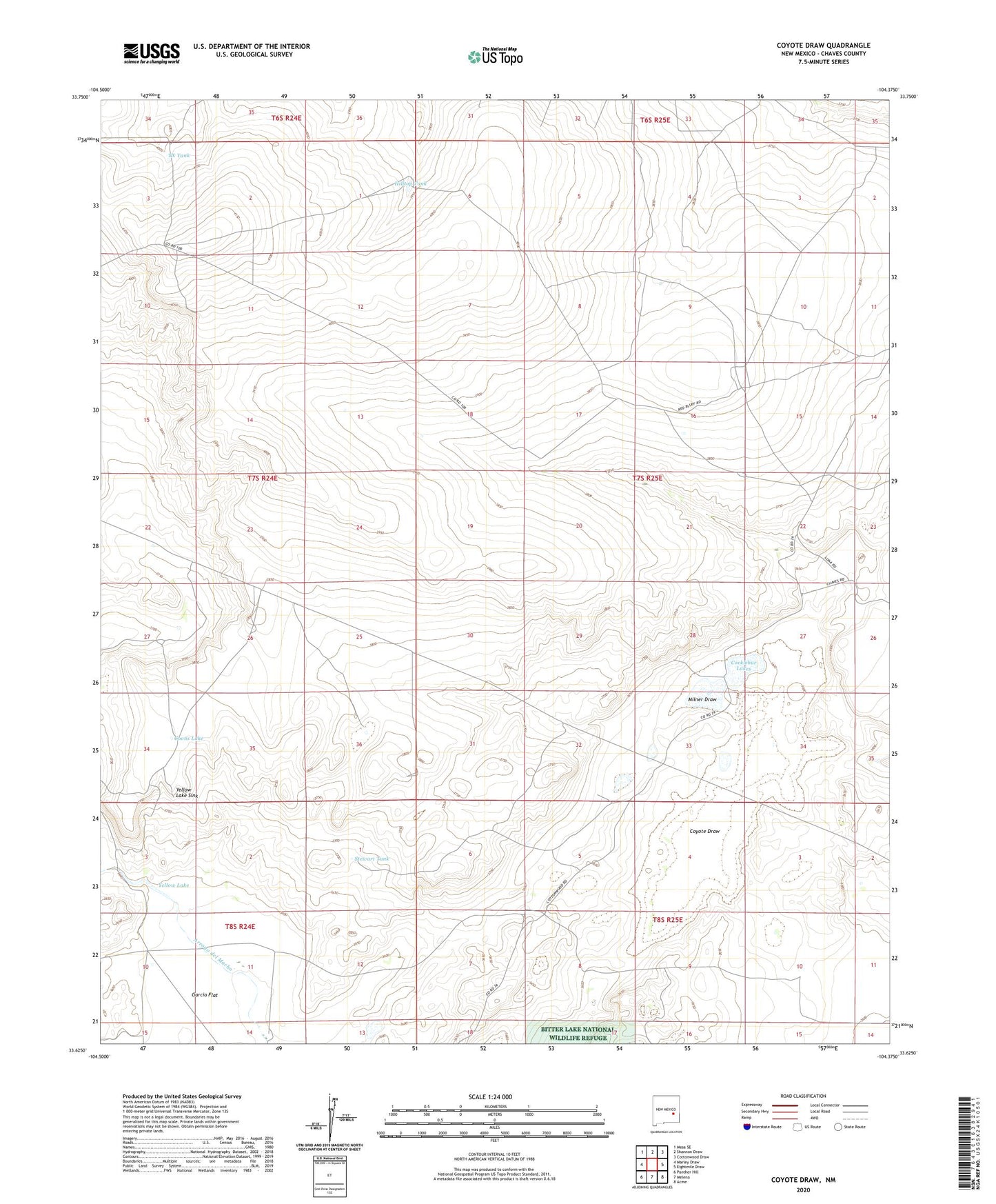
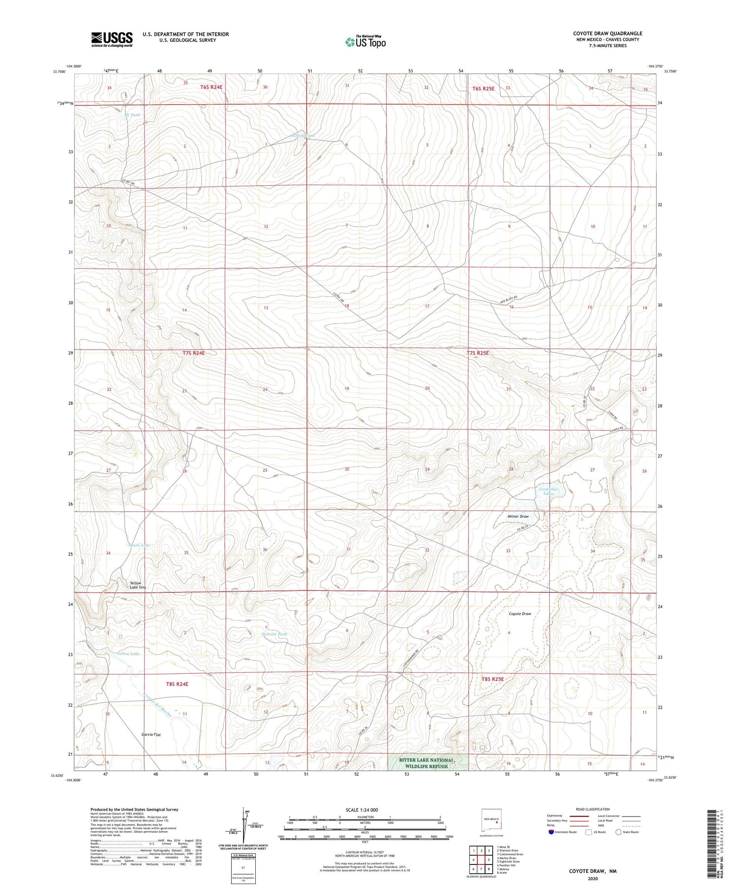
2023 topographic map quadrangle Coyote Draw in the state of New Mexico. Scale: 1:24000. Based on the newly updated USGS 7.5' US Topo map series, this map is in the following counties: Chaves. The map contains contour data, water features, and other items you are used to seeing on USGS maps, but also has updated roads and other features. This is the next generation of topographic maps. Printed on high-quality waterproof paper with UV fade-resistant inks.
Quads adjacent to this one:
West: Marley Draw
Northwest: Mesa SE
North: Shannon Draw
Northeast: Cottonwood Draw
East: Eightmile Draw
Southeast: Acme
South: Melena
Southwest: Panther Hill
This map covers the same area as the classic USGS quad with code o33104f4.
Contains the following named places: 10007 Water Well, 10714 Water Well, 10753 Water Well, 10755 Water Well, 10772 Water Well, 10776 Water Well, 10777 Water Well, 10797 Water Well, 88201, Acme Sand Pit, Cocklebur Lakes, Coons Lake, Coyote Draw, Dixon Well, Hilltop Tank, Milner Draw, Red Bluff Ranch, Savage Well, Smith Windmill, Stewart Tank, TX Tank, Yellow Lake, Yellow Lake Sink