MyTopo
Melena New Mexico US Topo Map
Couldn't load pickup availability
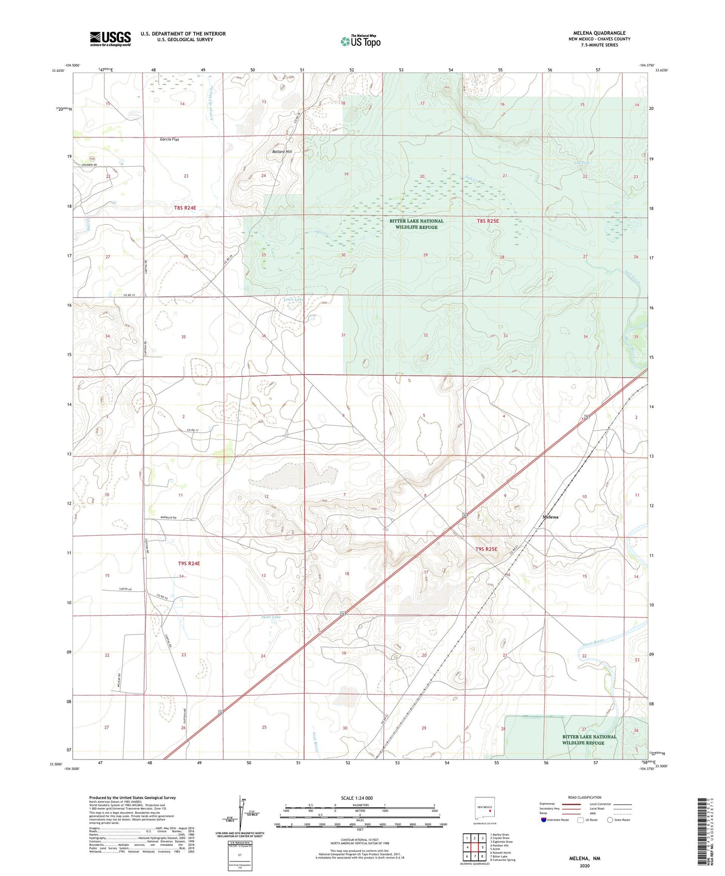
2023 topographic map quadrangle Melena in the state of New Mexico. Scale: 1:24000. Based on the newly updated USGS 7.5' US Topo map series, this map is in the following counties: Chaves. The map contains contour data, water features, and other items you are used to seeing on USGS maps, but also has updated roads and other features. This is the next generation of topographic maps. Printed on high-quality waterproof paper with UV fade-resistant inks.
Quads adjacent to this one:
West: Panther Hill
Northwest: Marley Draw
North: Coyote Draw
Northeast: Eightmile Draw
East: Acme
Southeast: Comanche Spring
South: Bitter Lake
Southwest: Roswell North
This map covers the same area as the classic USGS quad with code o33104e4.
Contains the following named places: Arroyo del Macho, Ballard Hill, Beavers Pit, Big Lake, Bitter Lake National Wildlife Refuge, Dunnahoo Hills, Garcia Flat, Ink Pots, Lowe Lake, Melena, Opal Garren Claims, Salt Creek, Salt Creek Wilderness, Shaw Lake, Skull Lake