MyTopo
Pinabetoso Peaks New Mexico US Topo Map
Couldn't load pickup availability
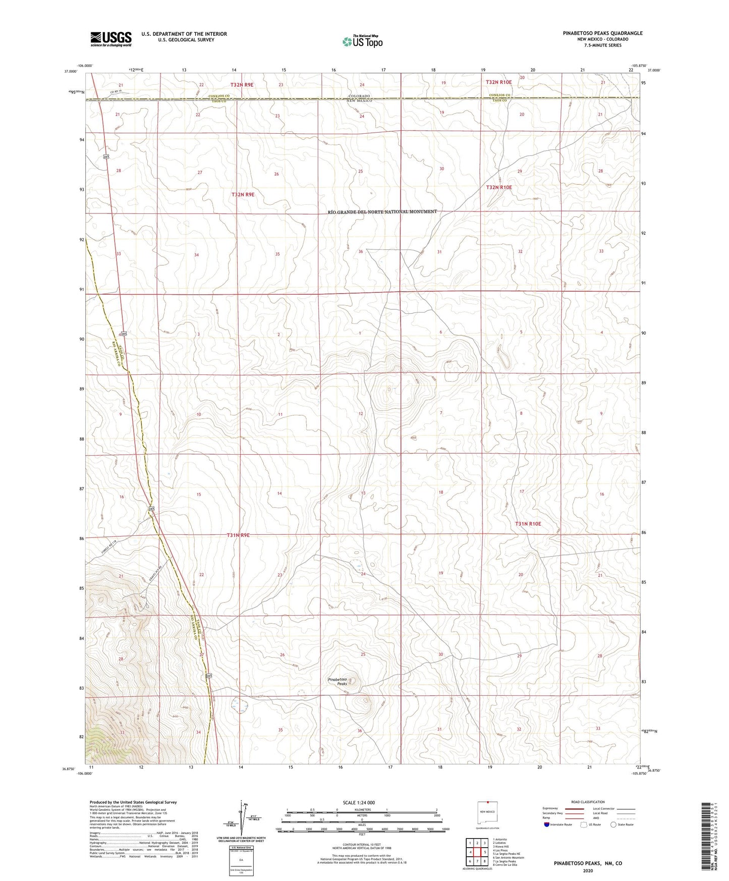
2020 topographic map quadrangle Pinabetoso Peaks in the state of New Mexico. Scale: 1:24000. Based on the newly updated USGS 7.5' US Topo map series, this map is in the following counties: Taos, Rio Arriba, Conejos. The map contains contour data, water features, and other items you are used to seeing on USGS maps, but also has updated roads and other features. This is the next generation of topographic maps. Printed on high-quality waterproof paper with UV fade-resistant inks.
Quads adjacent to this one:
West: Los Pinos
Northwest: Antonito
North: Lobatos
Northeast: Kiowa Hill
East: La Segita Peaks NE
Southeast: Cerro De La Olla
South: La Segita Peaks
Southwest: San Antonio Mountain
Contains the following named places: Maestas Antelope Guzzler, Maestas Antelope Guzzler Study Site, Pina Game Water Unit, Pinabetoso Peaks