MyTopo
Pleasant Hill New Mexico US Topo Map
Couldn't load pickup availability
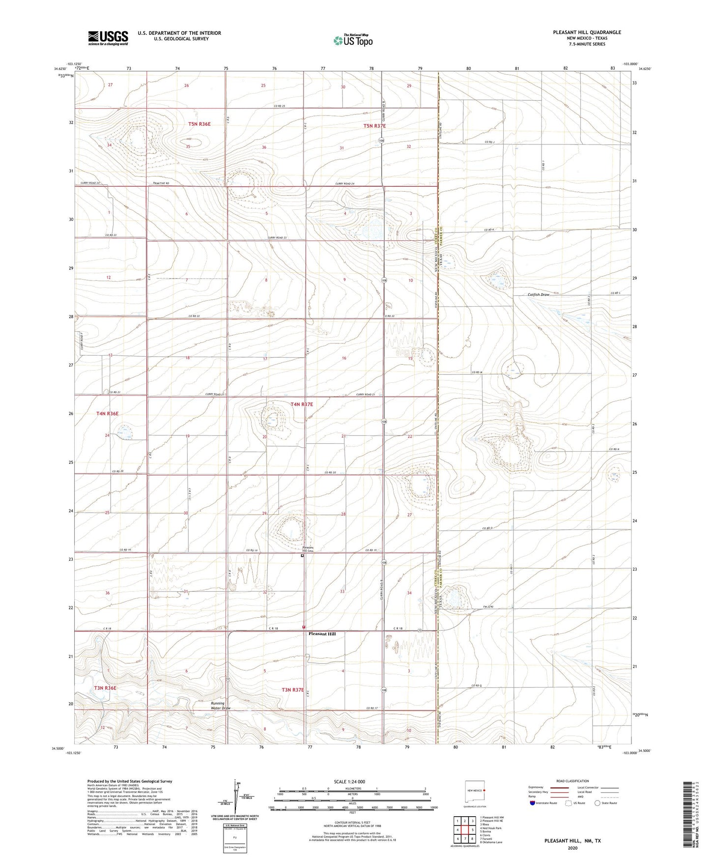
2023 topographic map quadrangle Pleasant Hill in the states of New Mexico, Texas. Scale: 1:24000. Based on the newly updated USGS 7.5' US Topo map series, this map is in the following counties: Curry, Parmer. The map contains contour data, water features, and other items you are used to seeing on USGS maps, but also has updated roads and other features. This is the next generation of topographic maps. Printed on high-quality waterproof paper with UV fade-resistant inks.
Quads adjacent to this one:
West: Ned Houk Park
Northwest: Pleasant Hill NW
North: Pleasant Hill NE
Northeast: Rhea
East: Bovina
Southeast: Oklahoma Lane
South: Farwell
Southwest: Clovis
Contains the following named places: Cross Country Dairy, McKillip Lake, McKillip Lake Dam, Pleasant Hill, Pleasant Hill Cemetery, Pleasant Hill Volunteer Fire Department, Providence Dairy, Ridgecrest Dairy, Route 77 Dairy, Veterly, ZIP Code: 88135