MyTopo
Pleasure Lake New Mexico US Topo Map
Couldn't load pickup availability
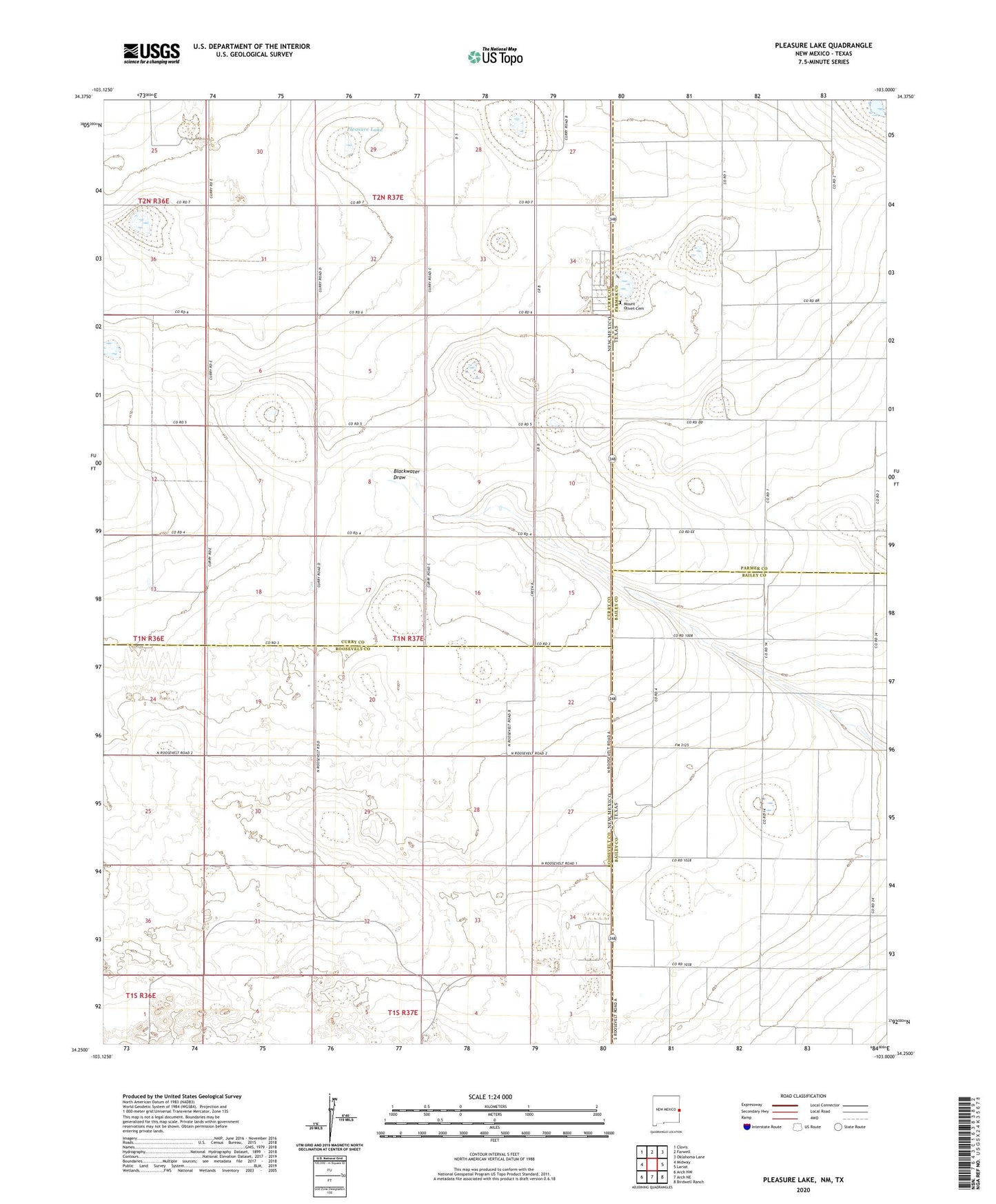
2023 topographic map quadrangle Pleasure Lake in the states of New Mexico, Texas. Scale: 1:24000. Based on the newly updated USGS 7.5' US Topo map series, this map is in the following counties: Curry, Roosevelt, Bailey, Parmer. The map contains contour data, water features, and other items you are used to seeing on USGS maps, but also has updated roads and other features. This is the next generation of topographic maps. Printed on high-quality waterproof paper with UV fade-resistant inks.
Quads adjacent to this one:
West: Midway
Northwest: Clovis
North: Farwell
Northeast: Oklahoma Lane
East: Lariat
Southeast: Birdwell Ranch
South: Arch NE
Southwest: Arch NW
Contains the following named places: 10830 Water Well, 11726 Water Well, 11727 Water Well, 11728 Water Well, 11729 Water Well, 11734 Water Well, 12240 Water Well, 12261 Water Well, 12262 Water Well, CC-659 Water Well, Desert Star Dairy, Hide - A - Way Dairy, Mid - Frisian Dairy, Mount Olivet Cemetery, Pleasure Lake