MyTopo
Midway New Mexico US Topo Map
Couldn't load pickup availability
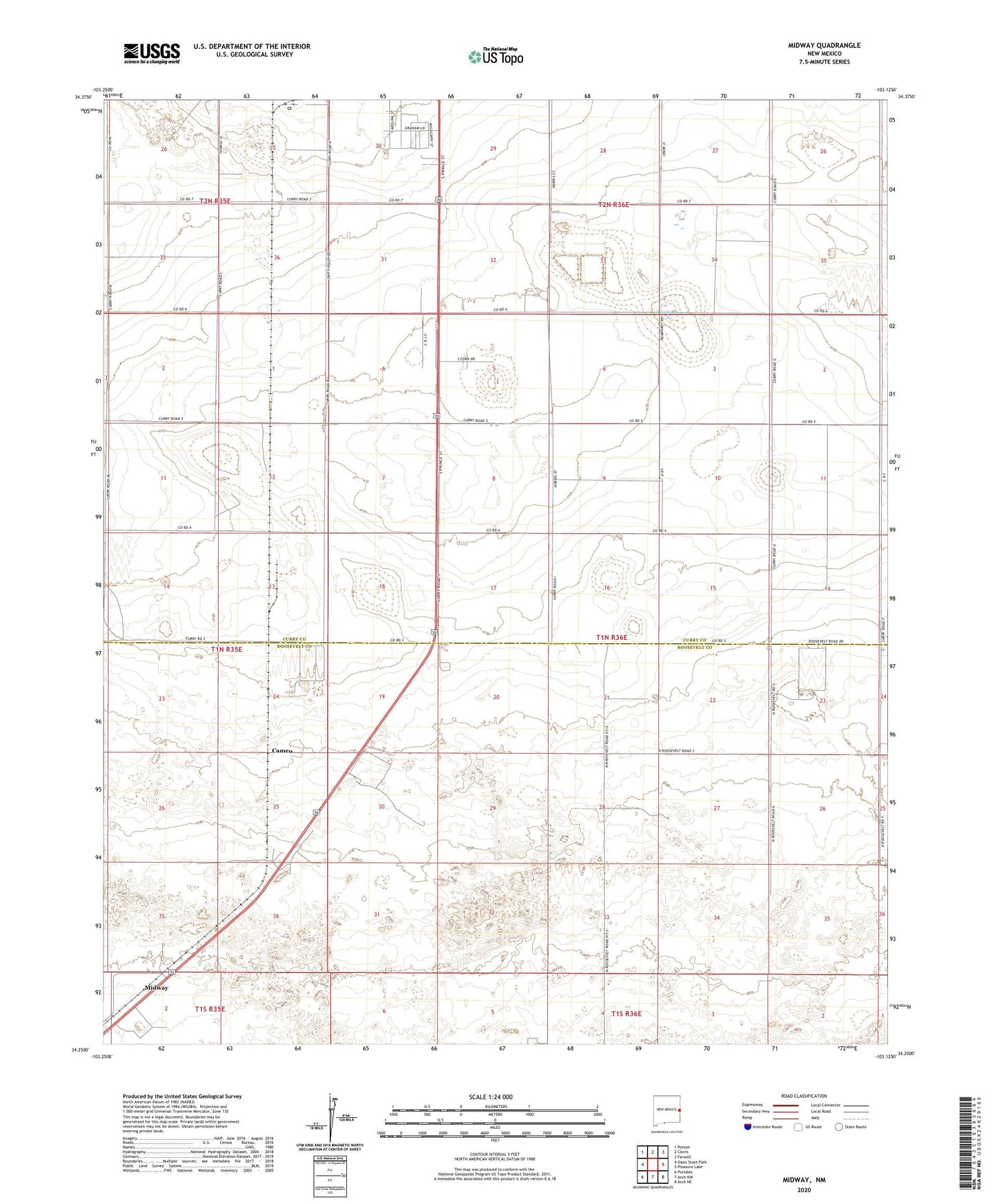
2023 topographic map quadrangle Midway in the state of New Mexico. Scale: 1:24000. Based on the newly updated USGS 7.5' US Topo map series, this map is in the following counties: Curry, Roosevelt. The map contains contour data, water features, and other items you are used to seeing on USGS maps, but also has updated roads and other features. This is the next generation of topographic maps. Printed on high-quality waterproof paper with UV fade-resistant inks.
Quads adjacent to this one:
West: Oasis State Park
Northwest: Portair
North: Clovis
Northeast: Farwell
East: Pleasure Lake
Southeast: Arch NE
South: Arch NW
Southwest: Portales
This map covers the same area as the classic USGS quad with code o34103c2.
Contains the following named places: 10022 Water Well, 10069 Water Well, 10807 Water Well, 10831 Water Well, 10833 Water Well, 11635 Water Well, 11696 Water Well, 11710 Water Well, 11711 Water Well, 11712 Water Well, 11730 Water Well, 12002 Water Well, 12167 Water Well, 12188 Water Well, 12241 Water Well, 12260 Water Well, 12385 Water Well, 12691 Water Well, 12710 Water Well, A and T Dairy, Cameo, CC-575 Water Well, Center School, Cooper - Legacy Dairy, Eastern New Mexico State Park, Grande Vida Dairy, Hardwick Ranch, Heritage Dairy, KTQM-FM (Clovis), KWKA-AM (Clovis), Launchpad Dairy, Midway, Midway Dairy, Native Pastures, Opportunity Dairy, Powerline Dairy, Rio Leche Dairy, Stewart Ranch