MyTopo
Portair New Mexico US Topo Map
Couldn't load pickup availability
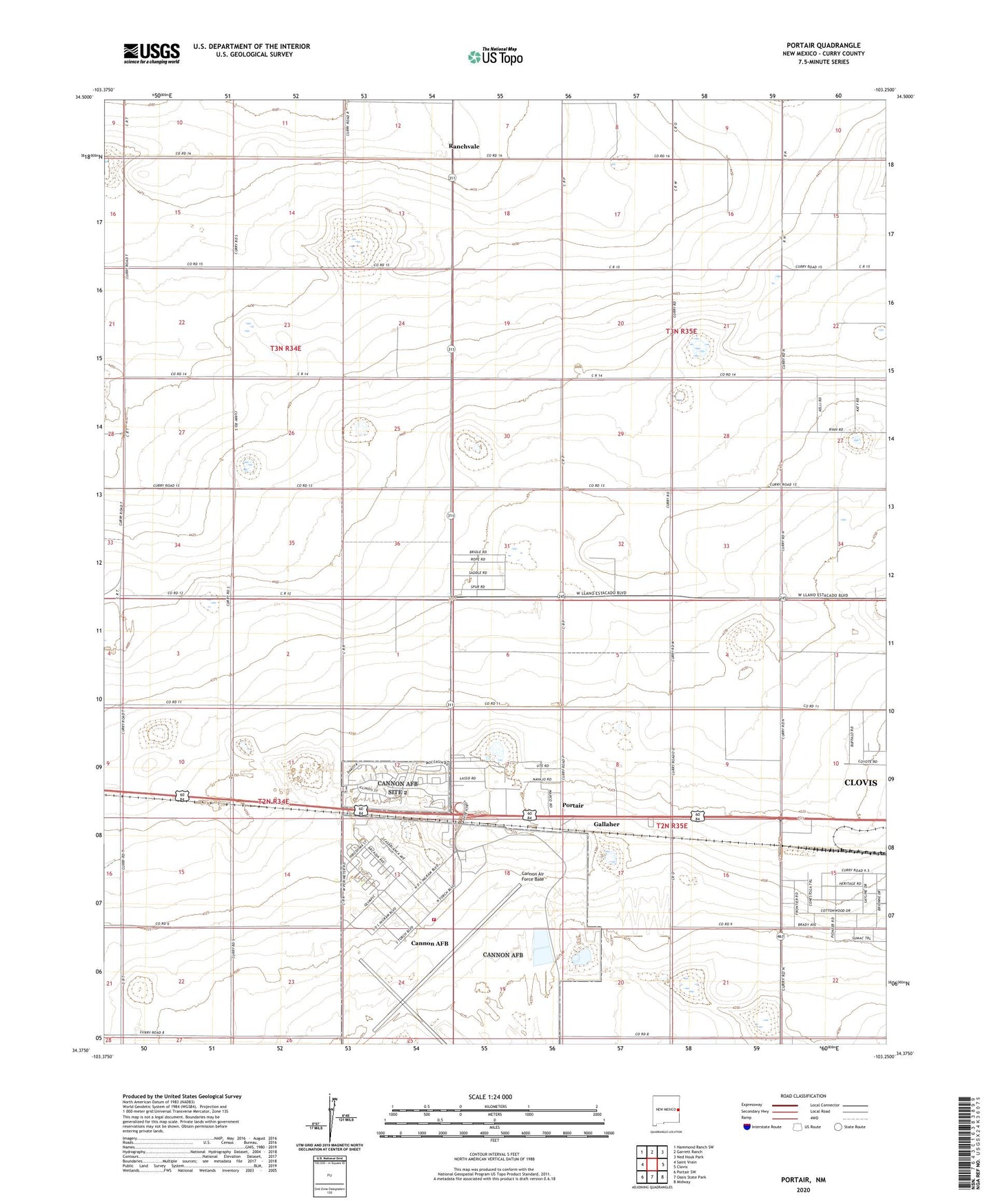
2023 topographic map quadrangle Portair in the state of New Mexico. Scale: 1:24000. Based on the newly updated USGS 7.5' US Topo map series, this map is in the following counties: Curry. The map contains contour data, water features, and other items you are used to seeing on USGS maps, but also has updated roads and other features. This is the next generation of topographic maps. Printed on high-quality waterproof paper with UV fade-resistant inks.
Quads adjacent to this one:
West: Saint Vrain
Northwest: Hammond Ranch SW
North: Garrett Ranch
Northeast: Ned Houk Park
East: Clovis
Southeast: Midway
South: Oasis State Park
Southwest: Portair SW
This map covers the same area as the classic USGS quad with code o34103d3.
Contains the following named places: 10059 Water Well, 10558 Water Well, 11233 Water Well, 88101, 88103, Cannon Air Force Base, Cannon Air Force Base Census Designated Place, Cannon Air Force Base Chapel, Cannon Air Force Base Fire Department, Gallaher, KICA-AM (Clovis), Portair, Rajen Dairy, Ranchvale, Ranchvale Post Office